Approximate Location Map
Large Map »
Latitude: 51.8321 / 51°49'55"N
Longitude: -0.2154 / 0°12'55"W
OS Eastings: 523069
OS Northings: 216334
OS Grid: TL230163
Mapcode National: GBR J8V.0DM
Mapcode Global: VHGPD.760W
Plus Code: 9C3XRQJM+RV
Entry Name: The Grange
Listing Date: 24 January 1967
Grade: II
Source: Historic England
Source ID: 1175068
English Heritage Legacy ID: 158574
ID on this website: 101175068
Location: Danesbury, Welwyn Hatfield, Hertfordshire, AL6
County: Hertfordshire
District: Welwyn Hatfield
Civil Parish: Welwyn
Built-Up Area: Welwyn
Traditional County: Hertfordshire
Lieutenancy Area (Ceremonial County): Hertfordshire
Church of England Parish: Welwyn and Woolmer Green
Church of England Diocese: St.Albans
Tagged with: Building
Welwyn
TL 2316 WELWYN CODICOTE ROAD
(east side)
14/307 No 3
(The Grange)
24.1.67
GV II
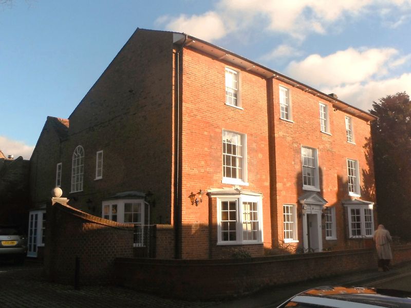
C18 and early C19 red brick house with L-plan rear extension.
Slate roof to front, old tile steep pitched roofs to rear. 3
storeys. Recessed sash windows. 4 to ground floor, outer ones
canted bays, 3 large 1st floor windows and 4 2nd floor windows.
Slightly projecting centre with pedimented doorcase, having
architrave surround, triglyph keyblock and scrolled brackets.
Scroll-bracketed eaves cornice.
Listing NGR: TL2306916334
External links are from the relevant listing authority and, where applicable, Wikidata. Wikidata IDs may be related buildings as well as this specific building. If you want to add or update a link, you will need to do so by editing the Wikidata entry.


Other nearby listed buildings
