Approximate Location Map
Large Map »
Latitude: 52.6039 / 52°36'14"N
Longitude: -2.5186 / 2°31'7"W
OS Eastings: 364972
OS Northings: 300810
OS Grid: SJ649008
Mapcode National: GBR BV.90MY
Mapcode Global: WH9DG.8TX3
Plus Code: 9C4VJF3J+HG
Entry Name: Arlescott Farm House
Listing Date: 24 October 1950
Grade: II
Source: Historic England
Source ID: 1176791
English Heritage Legacy ID: 254316
ID on this website: 101176791
Location: Shropshire, TF12
County: Shropshire
Civil Parish: Barrow
Traditional County: Shropshire
Lieutenancy Area (Ceremonial County): Shropshire
Church of England Parish: Linley with Willey and Barrow
Church of England Diocese: Hereford
Tagged with: Farmhouse
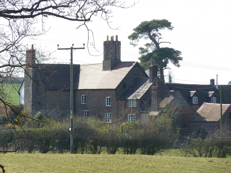
1.
l954 BARROW Arlescott
Farm House
SJ 60 SW 8/4 24.10.50.
II
2.
Early C17, Red brick with timber framed facade covered with modern Stucco.
L-shaped on plan with Slight alterations. Fenestration and doorcase mainly
modern. Contains some Jacobean panelling, an original open fireplace,
and doors and panelling of circa 1700 not in Situ.
Listing NGR: SJ6497200810
External links are from the relevant listing authority and, where applicable, Wikidata. Wikidata IDs may be related buildings as well as this specific building. If you want to add or update a link, you will need to do so by editing the Wikidata entry.


Other nearby listed buildings
