Approximate Location Map
Large Map »
Latitude: 52.188 / 52°11'16"N
Longitude: -2.5066 / 2°30'23"W
OS Eastings: 365461
OS Northings: 254537
OS Grid: SO654545
Mapcode National: GBR FV.4BTS
Mapcode Global: VH856.H8QJ
Plus Code: 9C4V5FQV+59
Entry Name: Orwell
Listing Date: 12 April 1973
Grade: II
Source: Historic England
Source ID: 1176992
English Heritage Legacy ID: 151053
ID on this website: 101176992
Location: Bromyard, County of Herefordshire, HR7
County: County of Herefordshire
Civil Parish: Bromyard and Winslow
Built-Up Area: Bromyard
Traditional County: Herefordshire
Lieutenancy Area (Ceremonial County): Herefordshire
Church of England Parish: Bromyard
Church of England Diocese: Hereford
Tagged with: Building
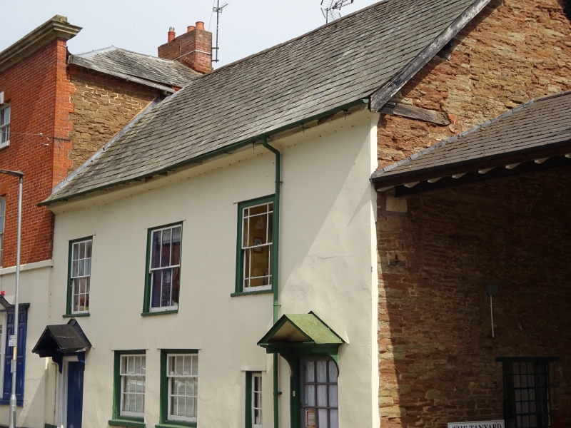
1.
1962 BROMYARD BROMYARD
PUMP STREET
(East Side)
Orwell
SO 6554 1/227
II GV
2.
C18. 2 storeys. Rubble refronted in stucco. Slate roof. 3 sash windows.
2 doors with open zinc covered pediments on corbels. Gable at rear.
Orwell. Tan House and Nunwell Priory form a group.
Listing NGR: SO6546154537
External links are from the relevant listing authority and, where applicable, Wikidata. Wikidata IDs may be related buildings as well as this specific building. If you want to add or update a link, you will need to do so by editing the Wikidata entry.


Other nearby listed buildings
