Latitude: 51.0426 / 51°2'33"N
Longitude: -3.3118 / 3°18'42"W
OS Eastings: 308133
OS Northings: 127848
OS Grid: ST081278
Mapcode National: GBR LR.GNTC
Mapcode Global: FRA 36YC.9ML
Plus Code: 9C3R2MVQ+27
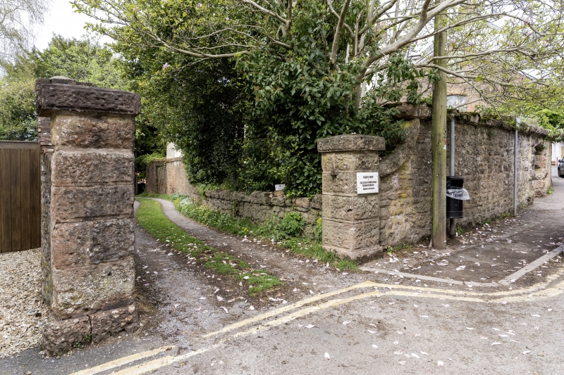
Entry Name: Three Gatepiers and Boundary Wall to No 5, East and West Boundary Walls to No 11 and the Garden Wall to No 9
Listing Date: 26 March 1984
Grade: II
Source: Historic England
Source ID: 1177304
English Heritage Legacy ID: 270156
ID on this website: 101177304
Location: Wiveliscombe, Somerset, TA4
County: Somerset
District: Somerset West and Taunton
Civil Parish: Wiveliscombe
Built-Up Area: Wiveliscombe
Traditional County: Somerset
Lieutenancy Area (Ceremonial County): Somerset
Tagged with: Building
ST0827 WIVELISCOMBE CP SILVER STREET (West side)
8/82 Three gatepiers and boundary wall to No 5, east and west boundary walls to No 11 and the garden wall to No 9 -
GV II
Boundary walls. Mid C19. Roughly coursed red sandstone with punched dressings and coping. 2 square gatepiers to yard of No 5 and a third marks the entry beside it to No 7 and 9 (q.v.). Boundary wall of No 11 (q.v.) along Silver Street has depressed triangular opening, the wall about 3 metres ramped down to gatepier. Winding drive formed of the east boundary wall to No 5 and the west wall of No 11, the latter continuing as part of the garden wall of No 9, pointed arch doorway. These walls originally formed the carriage entrance to the rear of No's 7 and 9 Silver Street (qv).
Listing NGR: ST0813327848
External links are from the relevant listing authority and, where applicable, Wikidata. Wikidata IDs may be related buildings as well as this specific building. If you want to add or update a link, you will need to do so by editing the Wikidata entry.


Other nearby listed buildings