Approximate Location Map
Large Map »
Latitude: 52.7817 / 52°46'54"N
Longitude: -1.3963 / 1°23'46"W
OS Eastings: 440817
OS Northings: 320633
OS Grid: SK408206
Mapcode National: GBR 7J1.MT9
Mapcode Global: WHDHM.JBBS
Plus Code: 9C4WQJJ3+MF
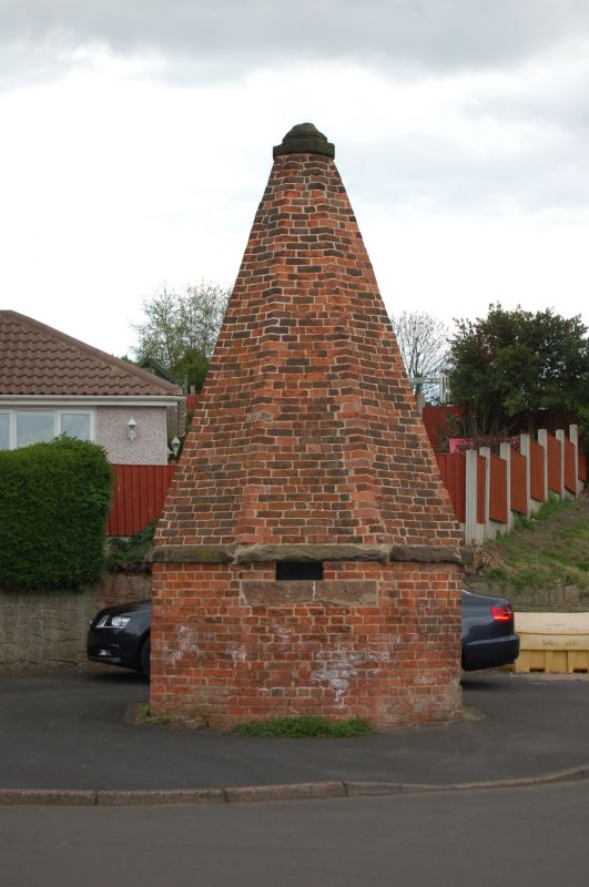
Entry Name: The Round House
Listing Date: 24 November 1965
Grade: II
Source: Historic England
Source ID: 1177699
English Heritage Legacy ID: 187857
ID on this website: 101177699
Location: Worthington, North West Leicestershire, LE65
County: Leicestershire
District: North West Leicestershire
Civil Parish: Worthington
Traditional County: Leicestershire
Lieutenancy Area (Ceremonial County): Leicestershire
Church of England Parish: Worthington St Matthew
Church of England Diocese: Leicester
SK 42 SW WORTHINGTON CHURCH LANE
2/90 The Round House
24.11.65
II
Lock up. Probably late c18. Brick throughout. One low octagonal storey
with a single plain doorway, & tall octagonal pyramidal brick roof on a stone
oversailing course, & capped by stone crown.
Listing NGR: SK4081720633
External links are from the relevant listing authority and, where applicable, Wikidata. Wikidata IDs may be related buildings as well as this specific building. If you want to add or update a link, you will need to do so by editing the Wikidata entry.


Other nearby listed buildings
