Latitude: 51.2705 / 51°16'13"N
Longitude: -2.4374 / 2°26'14"W
OS Eastings: 369580
OS Northings: 152460
OS Grid: ST695524
Mapcode National: GBR MY.088X
Mapcode Global: VH89P.PBSD
Plus Code: 9C3V7HC7+52
Entry Name: The Old Vicarage and Railings on Roadside
Listing Date: 11 March 1968
Grade: II
Source: Historic England
Source ID: 1177719
English Heritage Legacy ID: 267939
ID on this website: 101177719
Location: Kilmersdon, Somerset, BA3
County: Somerset
District: Mendip
Civil Parish: Kilmersdon
Traditional County: Somerset
Lieutenancy Area (Ceremonial County): Somerset
Tagged with: Clergy house
KILMERSDON CP CHURCH STREET (North side) ST65SE 11/156 No. 24 (The Old Vicarage) and railings on roadside 11.3.68 GV II
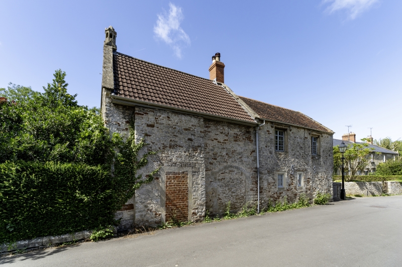
Vicarage, now house. Medieval origin, C18 and C19 alteration. Coursed rubble, concrete double-Roman tile and plain tile roofs, some coped verges, one rubble and 2 brick stacks, small stone arcaded chimney lantern. Cross gabled roof, main entrance front at right-angles to road. Two storeys, 3 bays, 2 and 3-light stone-mullioned windows, some leaded lights, sash windows with glazing bars. Central door opening, 6-panelled door, wooden shell hood on brackets and thin circular supports, trellis side panels. Elevation to road with 2 blocked door openings, freestone surrounds, one with 4-centred head. Interior stated to have medieval floor. Run of wrought-iron railings at right-angles to frontage, gate in conforming style.
Listing NGR: ST6957752465
External links are from the relevant listing authority and, where applicable, Wikidata. Wikidata IDs may be related buildings as well as this specific building. If you want to add or update a link, you will need to do so by editing the Wikidata entry.


Other nearby listed buildings