Approximate Location Map
Large Map »
Latitude: 52.6831 / 52°40'59"N
Longitude: -0.9209 / 0°55'15"W
OS Eastings: 473046
OS Northings: 310036
OS Grid: SK730100
Mapcode National: GBR BPT.N12
Mapcode Global: WHFKC.TTNF
Plus Code: 9C4XM3MH+6J
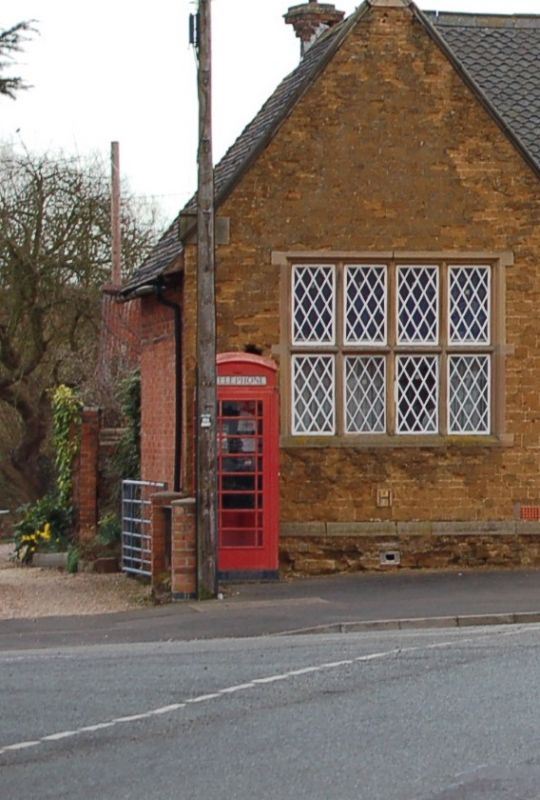
Entry Name: K6 Telephone Kiosk Adjoining the Old School
Listing Date: 7 January 1988
Grade: II
Source: Historic England
Source ID: 1177803
English Heritage Legacy ID: 189899
ID on this website: 101177803
Location: Twyford, Melton, Leicestershire, LE14
County: Leicestershire
District: Melton
Civil Parish: Twyford and Thorpe
Built-Up Area: Twyford
Traditional County: Leicestershire
Lieutenancy Area (Ceremonial County): Leicestershire
Church of England Parish: Twyford St Andrew
Church of England Diocese: Leicester
Tagged with: K6 telephone box
SK 71 SW TWYFORD AND THORPE BURROUGH ROAD
(north side)
9/142 K6 Telephone kiosk
adjoining the Old
School
G.V. II
K6 telephone kiosk. c.1935. Designed by Giles Gilbert Scott.
Cast iron with a wooden door to south.
Listing NGR: SK7304610036
External links are from the relevant listing authority and, where applicable, Wikidata. Wikidata IDs may be related buildings as well as this specific building. If you want to add or update a link, you will need to do so by editing the Wikidata entry.


Other nearby listed buildings
