Latitude: 52.5369 / 52°32'12"N
Longitude: -2.4195 / 2°25'10"W
OS Eastings: 371642
OS Northings: 293310
OS Grid: SO716933
Mapcode National: GBR BZ.F72M
Mapcode Global: VH90Z.0HRK
Plus Code: 9C4VGHPJ+Q5
Entry Name: 28 and 29, St Leonards Close
Listing Date: 9 March 1970
Grade: II
Source: Historic England
Source ID: 1178177
English Heritage Legacy ID: 254527
ID on this website: 101178177
Location: High Town, Shropshire, WV16
County: Shropshire
Civil Parish: Bridgnorth
Built-Up Area: Bridgnorth
Traditional County: Shropshire
Lieutenancy Area (Ceremonial County): Shropshire
Church of England Parish: Bridgnorth
Church of England Diocese: Hereford
Tagged with: Building
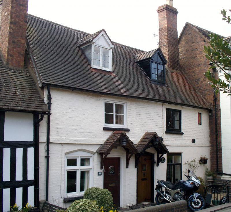
1. 1954 BRIDGNORTH ST LEONARD'S CLOSE
Nos 28 and 29 SO 79 SW 2/194 9.3.70.
II GV
2. C18. Colourwashed brick; 2 storeys; 2 casement windows; plain doorways with C19 tiled canopies; 2 dormers; tiles. Nos 26 to 30 (consec) form a group
Listing NGR: SO7164293310
External links are from the relevant listing authority and, where applicable, Wikidata. Wikidata IDs may be related buildings as well as this specific building. If you want to add or update a link, you will need to do so by editing the Wikidata entry.


Other nearby listed buildings