Latitude: 51.9883 / 51°59'17"N
Longitude: -2.9016 / 2°54'5"W
OS Eastings: 338186
OS Northings: 232584
OS Grid: SO381325
Mapcode National: GBR FB.JWDC
Mapcode Global: VH78H.N9F4
Plus Code: 9C3VX3QX+89
Entry Name: Moorhampton Bridge and abutments extending about 18 metres to West
Listing Date: 21 February 1984
Grade: II
Source: Historic England
Source ID: 1178465
English Heritage Legacy ID: 155077
Also known as: Moorhampton Bridge, HCC 135, over River Dore about 1100 yards ENE of Church of St Faith
Moorhampton Bridge and abutments extending about 20 yards to west
ID on this website: 101178465
Location: Bacton, County of Herefordshire, HR2
County: County of Herefordshire
Civil Parish: Abbey Dore
Traditional County: Herefordshire
Lieutenancy Area (Ceremonial County): Herefordshire
Church of England Parish: Abbeydore
Church of England Diocese: Hereford
Tagged with: Bridge Road bridge
The asset was previously listed twice also under the parish of Bacton at List entry 1302330. That entry was removed from the List on 26 November 2024.
This entry was subject to a Minor Amendment on 26 November 2024. The GIS triangle depiction was moved slightly from SO3818932586 to SO381632584, thus placing it on the parish boundary between Abbey Dore and Bacton which passes through the building. The grid reference was removed from the Details text.
ABBEY DORE CP
SO 33 SE
5/25
Moorhampton Bridge and abutments extending about 18 metres to West
II
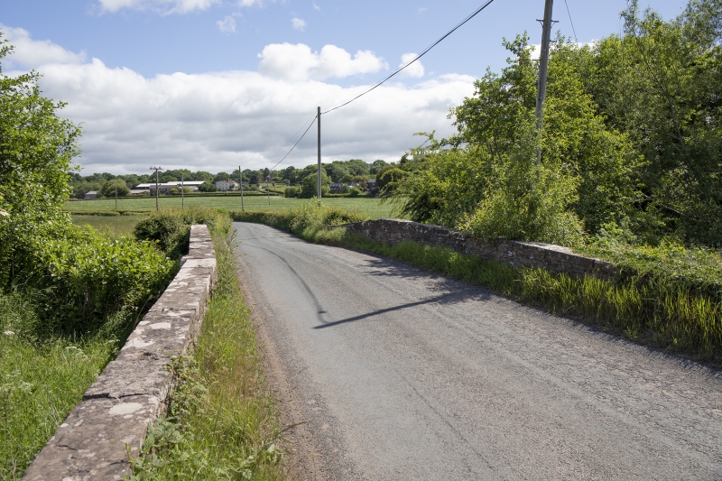
Bridge over River Dore. Probably mid-C19. Roughly coursed sandstone rubble with sandstone dressings. Single segmental arch with projecting keystone set in square-headed recessed panel which has a dentilled course at the top. Parapets are slightly cambered over arch; both parapets and abutments have flat copings.
External links are from the relevant listing authority and, where applicable, Wikidata. Wikidata IDs may be related buildings as well as this specific building. If you want to add or update a link, you will need to do so by editing the Wikidata entry.


Other nearby listed buildings