Approximate Location Map
Large Map »
Latitude: 53.3215 / 53°19'17"N
Longitude: -0.9513 / 0°57'4"W
OS Eastings: 469951
OS Northings: 381022
OS Grid: SK699810
Mapcode National: GBR PZS1.V1
Mapcode Global: WHFG8.CS71
Plus Code: 9C5X82CX+JF
Entry Name: Protestant Place
Listing Date: 5 November 1976
Grade: II
Source: Historic England
Source ID: 1179093
English Heritage Legacy ID: 240974
ID on this website: 101179093
Location: West Retford, Bassetlaw, Nottinghamshire, DN22
County: Nottinghamshire
District: Bassetlaw
Electoral Ward/Division: East Retford West
Parish: Non Civil Parish
Built-Up Area: Retford
Traditional County: Nottinghamshire
Lieutenancy Area (Ceremonial County): Nottinghamshire
Church of England Parish: Retford Team
Church of England Diocese: Southwell and Nottingham
Tagged with: Building
QUEEN STREET
1.
5345
(East Side)
Nos 1 to 15 (odd)
Protestant Place
SK 6981 10/120
II GV
2.
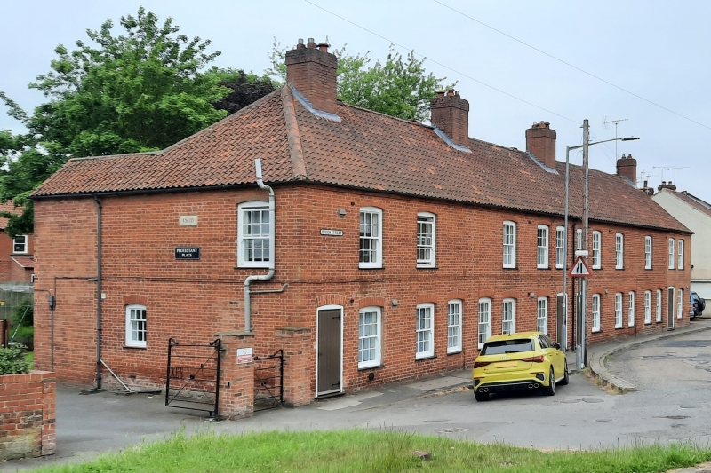
Dated 1826 to side. 2 storey cottage row of 2 storeys in red brick with hipped
pantile roof. 8 windows, segmental arches, sliding sashes with glazing bars,
on both floors. 8 segmental-headed doorways with doors of 6 panels. Brick stacks.
Nos 1 to 15 (odd) Protestant Place form a group.
Listing NGR: SK6995181022
External links are from the relevant listing authority and, where applicable, Wikidata. Wikidata IDs may be related buildings as well as this specific building. If you want to add or update a link, you will need to do so by editing the Wikidata entry.


Other nearby listed buildings
