Latitude: 54.242 / 54°14'31"N
Longitude: -1.9167 / 1°55'0"W
OS Eastings: 405526
OS Northings: 482926
OS Grid: SE055829
Mapcode National: GBR HM1D.V3
Mapcode Global: WHB5Y.JMHW
Plus Code: 9C6W63RM+R8
Entry Name: Farmbuilding Approximately 50 Metres South of Hall Farmhouse
Listing Date: 6 April 1988
Grade: II
Source: Historic England
Source ID: 1179223
English Heritage Legacy ID: 322537
ID on this website: 101179223
Location: Gammersgill, North Yorkshire, DL8
County: North Yorkshire
District: Richmondshire
Civil Parish: Carlton Highdale
Traditional County: Yorkshire
Lieutenancy Area (Ceremonial County): North Yorkshire
Tagged with: Agricultural structure
SE 08 SE
7/55
CARLTON HIGHDALE
GAMMERSGILL
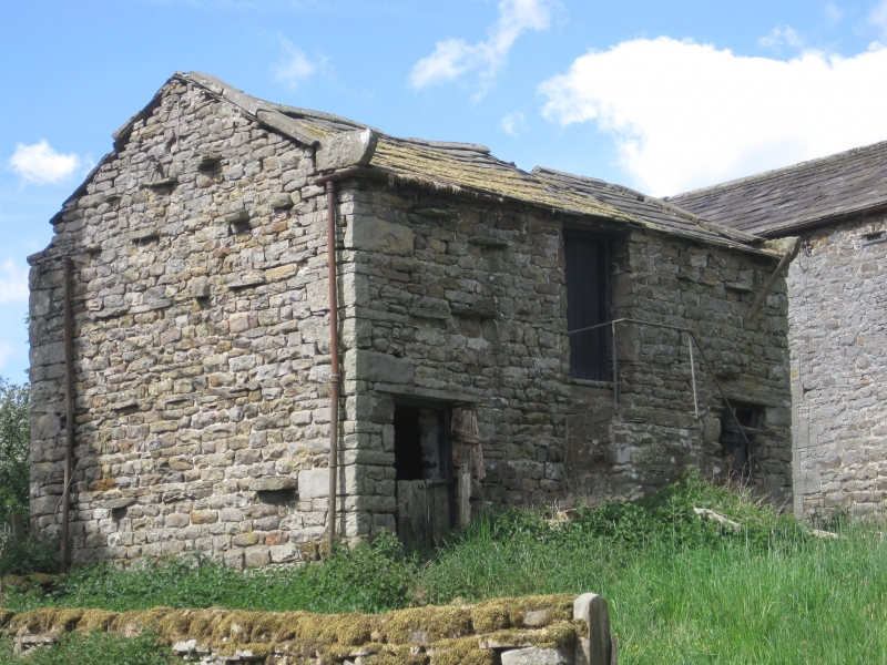
Farmbuilding approximately 50 metres south of Hall Farmhouse
GV
II
Farmbuilding. Late C18 - early C19. Rubble, stone slate roof. 2 storeys,
3 bays. Quoins. Ground floor, to left and right a board door with slab
lintel. First floor: central board pitching door. Large shaped kneelers.
Ashlar coping. Included for group value.
Listing NGR: SE0552682926
External links are from the relevant listing authority and, where applicable, Wikidata. Wikidata IDs may be related buildings as well as this specific building. If you want to add or update a link, you will need to do so by editing the Wikidata entry.


Other nearby listed buildings