Latitude: 54.3764 / 54°22'35"N
Longitude: -2.0126 / 2°0'45"W
OS Eastings: 399279
OS Northings: 497882
OS Grid: SD992978
Mapcode National: GBR GKDT.2Y
Mapcode Global: WHB5B.18W9
Plus Code: 9C6V9XGP+HX
Entry Name: Usha Top
Listing Date: 21 April 1986
Grade: II
Source: Historic England
Source ID: 1179426
English Heritage Legacy ID: 321981
ID on this website: 101179426
Location: Feetham, North Yorkshire, DL11
County: North Yorkshire
District: Richmondshire
Civil Parish: Grinton
Traditional County: Yorkshire
Lieutenancy Area (Ceremonial County): North Yorkshire
Tagged with: Architectural structure
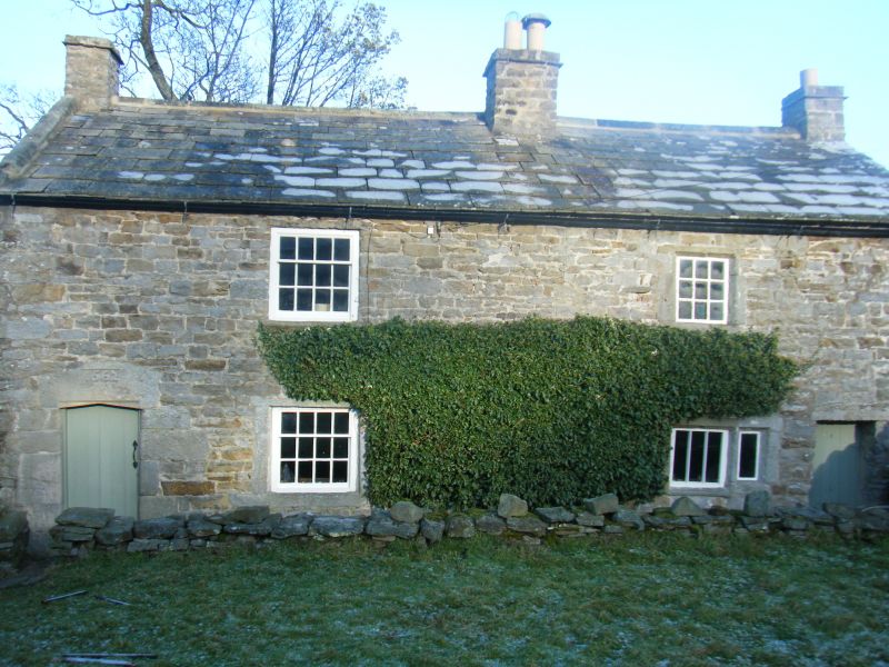
GRINTON HIGH LANE SD 99 NE (north side off) Whitaside 15/43 Usha Top GV II House. Dated 1662. Coursed watershot sandstone with ashlar dressings, stone slate roof. 2-cell axial stack plan of 2 storeys, added rear outshut. Crude quoins. Boarded door to left has chamfered quoined surround, deep lintel with triangular soffit has panel with date. A secondary doorway with boarded door inserted on right. 2 ground floor windows: left window has unequally-hung sash with glazing bars in stone surround, the lintel being an upturned 3-light mullioned-window lintel; to right 3-light, now 2-light, chamfered mullioned window with weather course above. Both first floor windows have unequally-hung sashes with glazing bars, the sill of the left window being a re-used drip mould. Raised coping on left. 3 stacks, at ends and a larger one between the 2 rooms. Harrison B. and Hutton B., Vernacular Houses in North Yorkshire and Cleveland, 1984, p 88. 'NYCVBSG Report', No 688.
Listing NGR: SD9927997882
External links are from the relevant listing authority and, where applicable, Wikidata. Wikidata IDs may be related buildings as well as this specific building. If you want to add or update a link, you will need to do so by editing the Wikidata entry.


Other nearby listed buildings