Latitude: 52.0347 / 52°2'4"N
Longitude: -2.4223 / 2°25'20"W
OS Eastings: 371127
OS Northings: 237447
OS Grid: SO711374
Mapcode National: GBR FZ.FV2F
Mapcode Global: VH860.Y4S1
Plus Code: 9C4V2HMH+V3
Entry Name: 16, the Southend
Listing Date: 5 November 1976
Grade: II
Source: Historic England
Source ID: 1180031
English Heritage Legacy ID: 151978
ID on this website: 101180031
Location: Ledbury, County of Herefordshire, HR8
County: County of Herefordshire
Civil Parish: Ledbury
Built-Up Area: Ledbury
Traditional County: Herefordshire
Lieutenancy Area (Ceremonial County): Herefordshire
Church of England Parish: Ledbury
Church of England Diocese: Hereford
Tagged with: Building
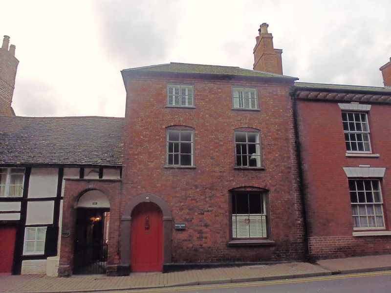
1.
5245 THE SOUTHEND
(West Side)
------------
No 16
SO 7137 SE 2/204
II GV
2.
C18 brick. Hipped tiled roof. 2 windows. 3 storeys. 2-light casements with
carving in cambered heads. Sash with margin panes on ground floor. Passageway
with stucco arch and keyblock and impost. Brick dentil eaves.
Nos 15, 16, 19 and 20 form a group.
Listing NGR: SO7112737447
External links are from the relevant listing authority and, where applicable, Wikidata. Wikidata IDs may be related buildings as well as this specific building. If you want to add or update a link, you will need to do so by editing the Wikidata entry.


Other nearby listed buildings