Latitude: 52.7254 / 52°43'31"N
Longitude: -2.1179 / 2°7'4"W
OS Eastings: 392133
OS Northings: 314197
OS Grid: SJ921141
Mapcode National: GBR 17W.5CP
Mapcode Global: WHBF6.FRPJ
Plus Code: 9C4VPVGJ+4R
Entry Name: Church Cottages
Listing Date: 2 January 1986
Grade: II
Source: Historic England
Source ID: 1180209
English Heritage Legacy ID: 271701
ID on this website: 101180209
Location: Penkridge, South Staffordshire, ST19
County: Staffordshire
District: South Staffordshire
Civil Parish: Penkridge
Built-Up Area: Penkridge
Traditional County: Staffordshire
Lieutenancy Area (Ceremonial County): Staffordshire
Church of England Parish: Penkridge St Michael and All Angels
Church of England Diocese: Lichfield
Tagged with: Cottage
SJ 9214-9314 PENKRIDGE C.P. CHURCH ROAD (South-west side)
9/52 Church Cottages -
GV II
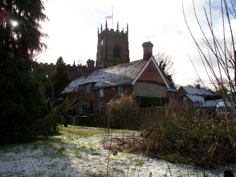
House, now divided into 3 cottages. C15 or early C16 with later alterations and additions. Timber framed with brick infill, partly rough-cast and partly replaced in brick; plain tile roof with shaped tile bands; brick ridge stack and integral end stacks. Aligned north- west/south-east, facing north-east; the building formerly comprised a 2-bay open hall (now floored) to the north-west and a single-bay chamber to the south-east, now floored but possibly open to the roof originally; the former entrance passage to the north-west end of the south-east bay is now blocked to form a lobby-entry. 2 storeys; 6 windows, mainly casements, early C19 glazing bar sash to ground floor left and early C19 glazing bar casement to first floor left; doors to right, left and centre. Interior: Left hand cottage has some exposed wall framing to the front wall, closely spaced studs with chamfered middle rail and herringbone pattern brick nogging, the present first floor is probably an C18 insertion; wall posts at the bay divisions are heavily jowelled; queen strut roof trusses with straight windbraces, those in the former hall smoke blackened.
Listing NGR: SJ9213414198
External links are from the relevant listing authority and, where applicable, Wikidata. Wikidata IDs may be related buildings as well as this specific building. If you want to add or update a link, you will need to do so by editing the Wikidata entry.


Other nearby listed buildings