Approximate Location Map
Large Map »
Latitude: 52.5356 / 52°32'8"N
Longitude: -2.4229 / 2°25'22"W
OS Eastings: 371411
OS Northings: 293163
OS Grid: SO714931
Mapcode National: GBR BZ.F67G
Mapcode Global: VH83H.YJGL
Plus Code: 9C4VGHPG+6R
Entry Name: 52, Whitburn Street
Listing Date: 12 January 1954
Grade: II
Source: Historic England
Source ID: 1180217
English Heritage Legacy ID: 254573
ID on this website: 101180217
Location: High Town, Shropshire, WV16
County: Shropshire
Civil Parish: Bridgnorth
Built-Up Area: Bridgnorth
Traditional County: Shropshire
Lieutenancy Area (Ceremonial County): Shropshire
Church of England Parish: Bridgnorth
Church of England Diocese: Hereford
Tagged with: Building
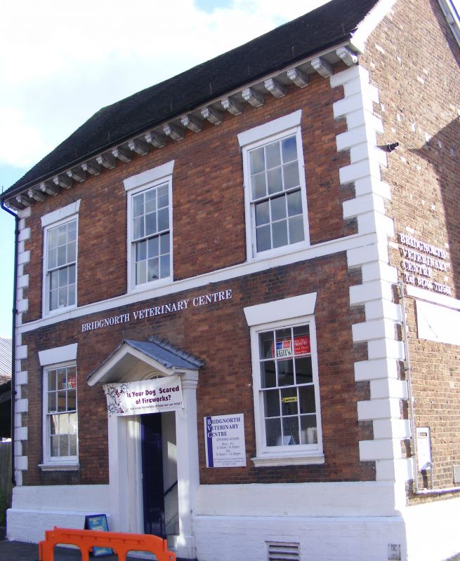
1.
1954 BRIDGNORTH
WHITBURN STREET
(South Side)
No 52
SO 79 SW 2/257 18.7.49.
II
2.
Mid C18. Red brick; 2 storeys; 3 sash windows; quoins; stringcourse;
moulded wood pilaster doorcase with pediment; carved wood modillion eaves;
tiles.
Listing NGR: SO7141193163
External links are from the relevant listing authority and, where applicable, Wikidata. Wikidata IDs may be related buildings as well as this specific building. If you want to add or update a link, you will need to do so by editing the Wikidata entry.


Other nearby listed buildings
