Latitude: 50.8934 / 50°53'36"N
Longitude: 0.2576 / 0°15'27"E
OS Eastings: 558868
OS Northings: 112864
OS Grid: TQ588128
Mapcode National: GBR MSN.ZY4
Mapcode Global: FRA C6FR.25W
Plus Code: 9F22V7V5+92
Entry Name: Shawpits Farmhouse
Listing Date: 12 August 1981
Grade: II
Source: Historic England
Source ID: 1180430
English Heritage Legacy ID: 295277
ID on this website: 101180430
Location: Hellingly, Wealden, East Sussex, BN27
County: East Sussex
District: Wealden
Civil Parish: Hellingly
Built-Up Area: Hellingly
Traditional County: Sussex
Lieutenancy Area (Ceremonial County): East Sussex
Church of England Parish: Hellingly St Peter and St Paul
Church of England Diocese: Chichester
Tagged with: Farmhouse
1.
5208
TQ 5812
33/636
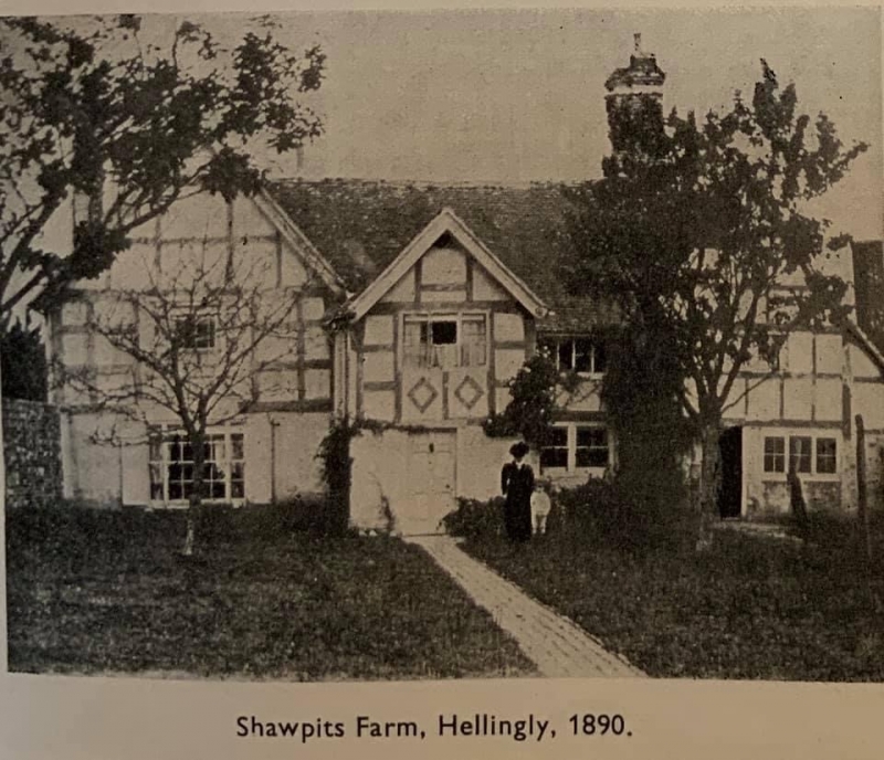
HELLINGLY
MILL LANE
Shawpits Farmhouse
II
2.
C17, restored. Two storeys. Four windows. Ground floor red brick, above
tile-hung. Gable at each end and later gabled projection in centre, Tiled
roof. Modern windows.
Listing NGR: TQ5886812864
External links are from the relevant listing authority and, where applicable, Wikidata. Wikidata IDs may be related buildings as well as this specific building. If you want to add or update a link, you will need to do so by editing the Wikidata entry.


Other nearby listed buildings