Latitude: 51.5769 / 51°34'36"N
Longitude: -0.9534 / 0°57'12"W
OS Eastings: 472620
OS Northings: 186964
OS Grid: SU726869
Mapcode National: GBR C49.5RJ
Mapcode Global: VHDW7.FMBJ
Plus Code: 9C3XH2GW+PJ
Entry Name: Ruins of Church of St James
Listing Date: 9 February 1959
Grade: II
Source: Historic England
Source ID: 1180736
English Heritage Legacy ID: 247033
ID on this website: 101180736
Location: South Oxfordshire, RG9
County: Oxfordshire
District: South Oxfordshire
Civil Parish: Bix and Assendon
Traditional County: Oxfordshire
Lieutenancy Area (Ceremonial County): Oxfordshire
Church of England Parish: Bix
Church of England Diocese: Oxford
BIX BIX BOTTOM SU78NW 2/15 Ruins of Church of St. James 09/02/59 - II
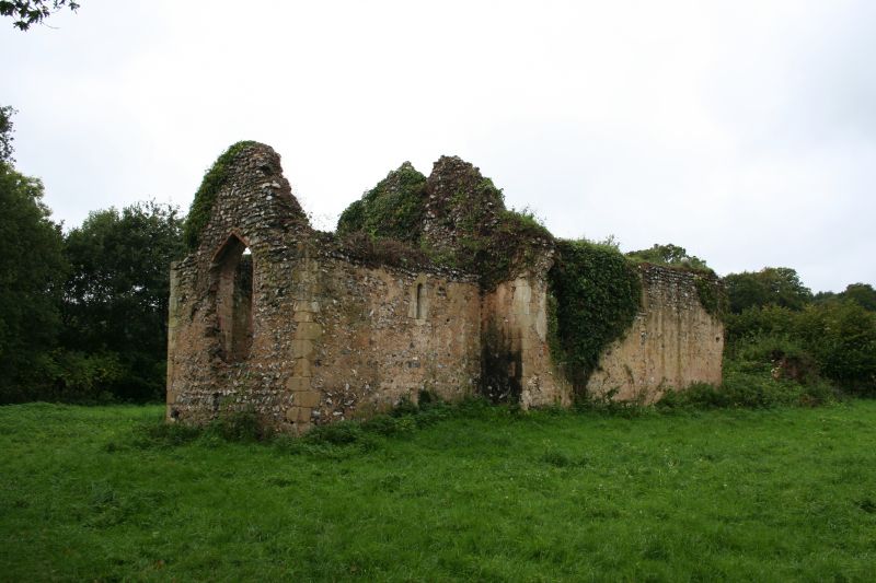
Church, now ruin. Romanesque. Flint with stone dressing and areas of render. Nave and chancel. Two window openings in south wall of nave, one in south wall of chancel. 2 window openings in north wall of nave, 1 in north wall of chancel. Pointed arched window opening in east wall of chancel. Round arched doorway to centre of south wall of nave. Interior: niche to each side of chancel arch. Scheduled as an Ancient Monument. (E.A. Greening Lamborn. 'The Churches of Bix', Oxoniensa, 1, 1936 p.129-139).
Listing NGR: SU7262086964


Other nearby listed buildings