Latitude: 51.6245 / 51°37'28"N
Longitude: -1.1394 / 1°8'21"W
OS Eastings: 459668
OS Northings: 192097
OS Grid: SU596920
Mapcode National: GBR 90V.0RL
Mapcode Global: VHCYH.6FHG
Plus Code: 9C3WJVF6+R6
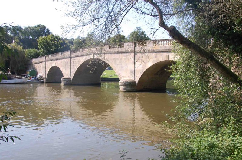
Entry Name: Shillingford Bridge
Listing Date: 18 July 1963
Grade: II*
Source: Historic England
Source ID: 1180968
English Heritage Legacy ID: 248165
ID on this website: 101180968
Location: Shillingford, South Oxfordshire, OX10
County: Oxfordshire
District: South Oxfordshire
Civil Parish: Warborough
Traditional County: Oxfordshire
Lieutenancy Area (Ceremonial County): Oxfordshire
Church of England Parish: Warborough
Church of England Diocese: Oxford
WARBOROUGH A329 SU5992 Shillingford 11/134 Shillingford Bridge (that part 18/07/63 in Warborough C.P.)
- II*
Bridge. 1826-7. Limestone ashlar and some red brick. Central section has 3 graduated segmental arches with projecting keyblocks, separated by shallow pilaster strips rising from cutwaters; balustraded parapet stands above a projecting band which breaks round the pilasters. Flanking sections have plain solid parapets: to south, curving outwards sharply to square piers; to north, forming a long causeway with 9 low plain arches in groups of 1,3 and 5. On the west face the flanking sections are mainly of brick. The bridge spans the River Thames.
Listing NGR: SU5966892097


Other nearby listed buildings