Latitude: 51.7885 / 51°47'18"N
Longitude: -1.1674 / 1°10'2"W
OS Eastings: 457523
OS Northings: 210310
OS Grid: SP575103
Mapcode National: GBR 8YN.ZLC
Mapcode Global: VHCXP.Q96S
Plus Code: 9C3WQRQM+92
Entry Name: Woodperry Farmhouse
Listing Date: 18 July 1963
Grade: II
Source: Historic England
Source ID: 1182633
English Heritage Legacy ID: 246703
ID on this website: 101182633
Location: Beckley, South Oxfordshire, OX33
County: Oxfordshire
District: South Oxfordshire
Civil Parish: Stanton St. John
Traditional County: Oxfordshire
Lieutenancy Area (Ceremonial County): Oxfordshire
Church of England Parish: Stanton St John
Church of England Diocese: Oxford
Tagged with: Farmhouse
STANTON ST. JOHN WOODPERRY SP51SE 2/183 Woodperry Farmhouse 18/07/63
- II
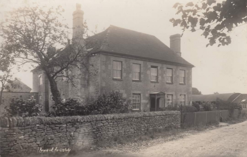
Farmhouse. Early C18. Coursed and uncoursed limestone rubble and ashlar dressings; old plain-tile roof. L-plan. 2 storeys plus attics. Symmetrical 5-window front in coursed rubble, has central 6-panel door with rectangular overlight, and renewed 12-pane sashes all with stone flat arches. Hipped roof with moulded wooden fascia. End walls have large stone projecting chimneys with weathered offsets and brick shafts. 4-window rear wing returns to left and has remains of several cross windows. Rear of main range and wing have hipped roof dormers. Interior not inspected.
Listing NGR: SP5752310310
External links are from the relevant listing authority and, where applicable, Wikidata. Wikidata IDs may be related buildings as well as this specific building. If you want to add or update a link, you will need to do so by editing the Wikidata entry.


Other nearby listed buildings