Latitude: 51.6396 / 51°38'22"N
Longitude: -1.5405 / 1°32'25"W
OS Eastings: 431892
OS Northings: 193520
OS Grid: SU318935
Mapcode National: GBR 6XG.1BR
Mapcode Global: VHC0T.71YX
Plus Code: 9C3WJFQ5+RQ
Entry Name: Church Farmhouse
Listing Date: 21 November 1966
Grade: II
Source: Historic England
Source ID: 1182640
English Heritage Legacy ID: 251030
ID on this website: 101182640
Location: Shellingford, Vale of White Horse, Oxfordshire, SN7
County: Oxfordshire
District: Vale of White Horse
Civil Parish: Shellingford
Traditional County: Berkshire
Lieutenancy Area (Ceremonial County): Oxfordshire
Church of England Parish: Shellingford
Church of England Diocese: Oxford
Tagged with: Farmhouse
SHELLINGFORD CHURCH STREET SU39SW (North side) 5/200 Church Farmhouse 21/11/66 GV II
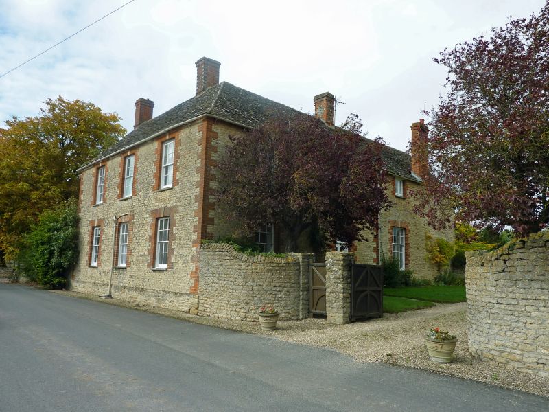
Farmhouse. Early C19 front and right wing to C17 house. Coursed limestone rubble; brick dressings; stone slate roof. 2 storeys; 3-window range. Flat gauged brick arch with keystone over. 4-panelled (2 glazed) door with fan set in overlight. Flat gauged brick arches with keystones and brick jambs to sashes and mid C19 horned 12-pane sash to right of door with C20 two-light casement over. Gabled roof to right and hipped to left at join with rear wing; C18 front lateral stack, ridge stacks to main range and rear wing, gable end stack to rear left. Similar sashes and surrounds in 3-window range of left side wall. Timber lintels and brick jambs to sashes in right gable wall. Interior: C19 panelled and plank doors; plain early C19 straight-flight stairs opposite entry; hall also features wood bressumer over C17 open fireplace which was blocked in the early C19.
Listing NGR: SU3189293520
External links are from the relevant listing authority and, where applicable, Wikidata. Wikidata IDs may be related buildings as well as this specific building. If you want to add or update a link, you will need to do so by editing the Wikidata entry.


Other nearby listed buildings