Latitude: 51.626 / 51°37'33"N
Longitude: -1.4859 / 1°29'9"W
OS Eastings: 435685
OS Northings: 192035
OS Grid: SU356920
Mapcode National: GBR 6XQ.34F
Mapcode Global: VHC0V.6DBB
Plus Code: 9C3WJGG7+CM
Entry Name: Goosey House Farmhouse and Walls
Listing Date: 24 November 1966
Last Amended: 6 December 1985
Grade: II
Source: Historic England
Source ID: 1182739
English Heritage Legacy ID: 251131
ID on this website: 101182739
Location: Goosey, Vale of White Horse, Oxfordshire, SN7
County: Oxfordshire
District: Vale of White Horse
Civil Parish: Goosey
Traditional County: Berkshire
Lieutenancy Area (Ceremonial County): Oxfordshire
Church of England Parish: Stanford-in-the-Vale with Goosey and Hatford
Church of England Diocese: Oxford
Tagged with: Farmhouse
GOOSEY GOOSEY GREEN SU39SE (South side) 1/37 Goosey House Farmhouse and 24/11/66 walls (Formerly listed as Goosey House Farmhouse)
GV II
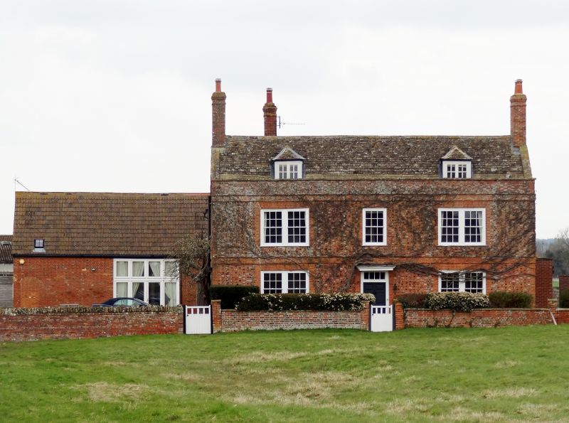
Farmhouse. Mid C18. Flemish bond brick with flared headers; stone slate roof; brick stacks. L-plan. Two storeys and attic; 3-window range. Flat hood with panelled soffit over 6-panelled door with overlight. Gauged brick flat arches over central first-floor sash and flanking paired sashes. Storey and parapet bands; parapet with stone coping. Hipped roof dormers with 2-light leaded casements. Gabled roof with stone coping; brick gable end stack. 2-storey, 2-window range to rear left, of similar materials, has one-storey, one-bay dairy and cheese room with hipped slate-hung dormer to rear. Interior: 6-panelled doors. Dog-leg staircase with landing has stick balusters with banisters ramped to newels. Mid C18 fireplaces to right. Bread oven to rear left. Common-rafter roof. Dairy and cheese room block to rear left has quarter-turn stairs and 2-bay roof with bent inner principals to open collar-truss. Subsidiary features: Wall to front of random bond brick with stone coping; 4 square piers with central piers flanking gate; wall continues approx. 20m. to right. Similar wall with ramped stone coping to rear right.
Listing NGR: SU3568592035
External links are from the relevant listing authority and, where applicable, Wikidata. Wikidata IDs may be related buildings as well as this specific building. If you want to add or update a link, you will need to do so by editing the Wikidata entry.


Other nearby listed buildings