Latitude: 51.4099 / 51°24'35"N
Longitude: -1.7881 / 1°47'16"W
OS Eastings: 414837
OS Northings: 167892
OS Grid: SU148678
Mapcode National: GBR 4X5.JRY
Mapcode Global: VHB45.YTLK
Plus Code: 9C3WC656+WQ
Entry Name: Hillside Cottage
Listing Date: 2 September 1986
Grade: II
Source: Historic England
Source ID: 1182819
English Heritage Legacy ID: 311389
ID on this website: 101182819
Location: Lockeridge, Wiltshire, SN8
County: Wiltshire
Civil Parish: West Overton
Built-Up Area: Lockeridge
Traditional County: Wiltshire
Lieutenancy Area (Ceremonial County): Wiltshire
Tagged with: Cottage Thatched cottage
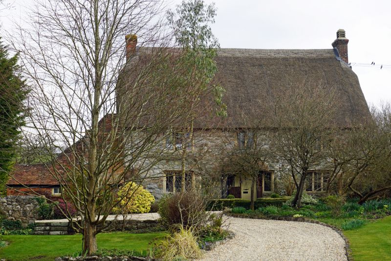
SU 16 NW WEST OVERTON LOCKERIDGE (east side) 9/137 Hillside Cottage II House. Late C17-early C18. Sarsen with limestone dressings, thatched roof. Two storeys, 3 bays with brick and tiled extension on left. Central boarded door with rustic thatched canopy leading to stair hall. Two and 3-light windows with rebated and ogee moulded mullions and surround and label moulds above. Gable brick stacks. Long sloping roof to lean-to with tall brick stack.
Listing NGR: SU1483767892
External links are from the relevant listing authority and, where applicable, Wikidata. Wikidata IDs may be related buildings as well as this specific building. If you want to add or update a link, you will need to do so by editing the Wikidata entry.


Other nearby listed buildings