Latitude: 51.2202 / 51°13'12"N
Longitude: -1.7743 / 1°46'27"W
OS Eastings: 415861
OS Northings: 146802
OS Grid: SU158468
Mapcode National: GBR 4ZJ.G7Y
Mapcode Global: VHB55.6LCG
Plus Code: 9C3W66CG+37
Entry Name: Ablington Farmhouse
Listing Date: 10 October 1988
Grade: II
Source: Historic England
Source ID: 1183066
English Heritage Legacy ID: 321479
ID on this website: 101183066
Location: Ablington, Wiltshire, SP4
County: Wiltshire
Civil Parish: Figheldean
Traditional County: Wiltshire
Lieutenancy Area (Ceremonial County): Wiltshire
Church of England Parish: Figheldean St Michael and All Angels
Church of England Diocese: Salisbury
Tagged with: Farmhouse Thatched farmhouse
FIGHELDEAN ABLINGTON SU 14 NE (south side)
2/169 Ablington Farmhouse
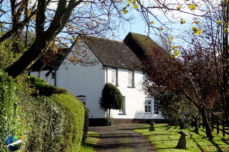
II Farmhouse. C18. Chalk cob, with thatched roof. Extensions in brick with various tiled roofs. Two storeys, 4 cell plan with continuous outshut, and wings added to rear, both ends, the west kitchen wing with inner bay of c1880 and later single storey additions. Entrance to stair hall in second bay from west. Panelled door. Paned timber windows, but canted bay to central living room, square bay to west end drawing room, and some leaded windows to billiard room at east end. Stair formerly in outshut. Three brick stacks.
Listing NGR: SU1586146802
External links are from the relevant listing authority and, where applicable, Wikidata. Wikidata IDs may be related buildings as well as this specific building. If you want to add or update a link, you will need to do so by editing the Wikidata entry.


Other nearby listed buildings