Latitude: 51.5985 / 51°35'54"N
Longitude: -1.6534 / 1°39'12"W
OS Eastings: 424102
OS Northings: 188908
OS Grid: SU241889
Mapcode National: GBR 5WC.NSZ
Mapcode Global: VHC0Y.928X
Plus Code: 9C3WH8XW+CJ
Entry Name: Oakwood House and the Close
Listing Date: 31 October 1983
Grade: II
Source: Historic England
Source ID: 1183143
English Heritage Legacy ID: 250600
ID on this website: 101183143
Location: Shrivenham, Vale of White Horse, Oxfordshire, SN6
County: Oxfordshire
District: Vale of White Horse
Civil Parish: Shrivenham
Built-Up Area: Shrivenham
Traditional County: Berkshire
Lieutenancy Area (Ceremonial County): Oxfordshire
Church of England Parish: Shrivenham with Watchfield and Bourton
Church of England Diocese: Oxford
Tagged with: Architectural structure
1. SHRIVENHAM HIGH STREET (south side) So 2488 8/51 Oakwood House and The Close II
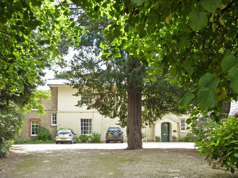
2. Circa 1820 former Vicarage with a mid C19 E addition, now two dwellings. Oakwood House extends through 3 bays of the original Vicarage and The Close occupies the 4th bay of the former vicar's house and the 1 bay later extension. The Vicarage section is of rubble stone faced with limewashed render with a very shallow hipped slate roof and 2 brick stacks, one on a stone base at the W end. The later addition is of rubble stone and brick openings also with a slate roof. 2 storeys with a N front of 4 widely spaced bays with sashes, 4 panes wide, throughout. lst floor string course and a gabled rendered porch with slate roof sheltering a 4 panelled door with 2 glazed lights. The 2 storey, 1 bay E addition also has sashes 4 panes wide. To the rear under the deeply projecting eaves which is a feature of both facades, is a SW bow with blind boxes to the ground floor sash windows. Inside, the bow has reeded architraves with stopped roundels and panelled shutters to the windows and similar architraves to the doors. There is also a cantilevered staircase with mahogany handrail, thin squared balusters and carved tread-ends.
Listing NGR: SU2410288908
External links are from the relevant listing authority and, where applicable, Wikidata. Wikidata IDs may be related buildings as well as this specific building. If you want to add or update a link, you will need to do so by editing the Wikidata entry.


Other nearby listed buildings