Latitude: 51.5888 / 51°35'19"N
Longitude: -1.4285 / 1°25'42"W
OS Eastings: 439690
OS Northings: 187930
OS Grid: SU396879
Mapcode National: GBR 6Y5.CNK
Mapcode Global: VHC12.6B5B
Plus Code: 9C3WHHQC+GJ
Entry Name: Lamp Post Approximately 10 Metres North of Church of St Peter and St Paul
Listing Date: 6 December 1985
Grade: II
Source: Historic England
Source ID: 1183228
English Heritage Legacy ID: 251158
ID on this website: 101183228
Location: Wantage, Vale of White Horse, Oxfordshire, OX12
County: Oxfordshire
District: Vale of White Horse
Civil Parish: Wantage
Built-Up Area: Wantage
Traditional County: Berkshire
Lieutenancy Area (Ceremonial County): Oxfordshire
Tagged with: Streetlight
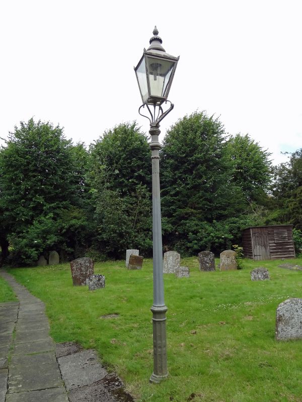
WANTAGE CHURCH STREET
SU3987NE (North side)
9/63 Lamp post approx. 10m. N of
Church of St. Peter and St.
Paul
GV II
Lamp post. Mid C19. Gas lantern on fluted cast-iron column. Good example.
Included for group value.
Listing NGR: SU3969087930
External links are from the relevant listing authority and, where applicable, Wikidata. Wikidata IDs may be related buildings as well as this specific building. If you want to add or update a link, you will need to do so by editing the Wikidata entry.


Other nearby listed buildings