Latitude: 53.6021 / 53°36'7"N
Longitude: -1.6966 / 1°41'47"W
OS Eastings: 420174
OS Northings: 411768
OS Grid: SE201117
Mapcode National: GBR JVLS.HG
Mapcode Global: WHCB8.XQ8F
Plus Code: 9C5WJ823+R9
Entry Name: Wood Nook Farmhouse
Listing Date: 16 May 1984
Grade: II
Source: Historic England
Source ID: 1183817
English Heritage Legacy ID: 341167
ID on this website: 101183817
Location: Shelley, Kirklees, West Yorkshire, HD8
County: Kirklees
Civil Parish: Kirkburton
Traditional County: Yorkshire
Lieutenancy Area (Ceremonial County): West Yorkshire
Church of England Parish: Shelley Emmanuel
Church of England Diocese: Leeds
Tagged with: Farmhouse
SE 21 SW HUDDERSFIELD ROAD Shelley 6/53 Wood Nook Farmhouse II
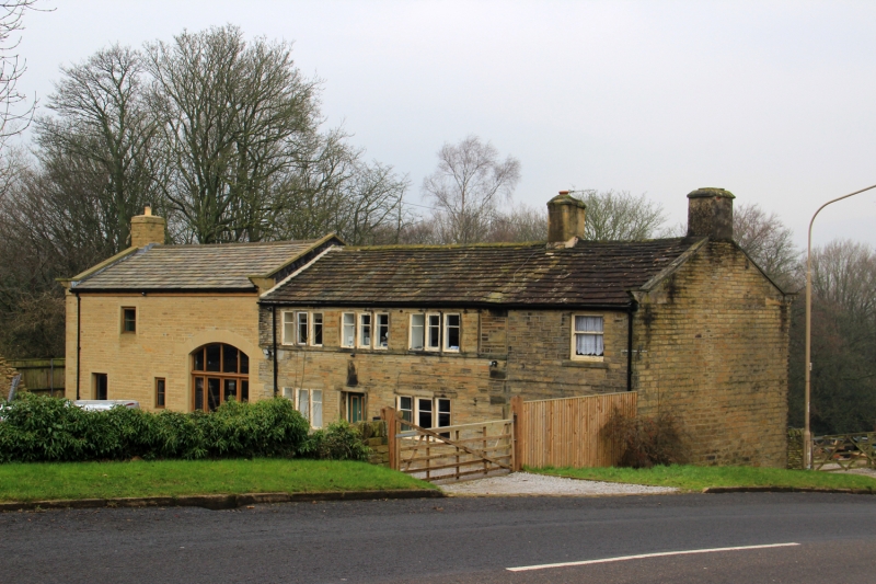
Farmhouse. Late C18 or early C19. Hammer dressed stone with quoins to right. Stone slate roof with gable copings on cut kneelers. Two gable stacks. Two storeys. Central doorway with small plaque over with no inscription. To left and right, one 3-light window. Former continuous 12-light window now with 3 blocked lights, giving three 3-light windows.
Listing NGR: SE2017411768
External links are from the relevant listing authority and, where applicable, Wikidata. Wikidata IDs may be related buildings as well as this specific building. If you want to add or update a link, you will need to do so by editing the Wikidata entry.


Other nearby listed buildings