Latitude: 51.6059 / 51°36'21"N
Longitude: -1.8048 / 1°48'17"W
OS Eastings: 413612
OS Northings: 189696
OS Grid: SU136896
Mapcode National: GBR 4TV.6JV
Mapcode Global: VHB36.NWQR
Plus Code: 9C3WJ54W+93
Entry Name: Church of St Andrew
Listing Date: 26 January 1955
Grade: II*
Source: Historic England
Source ID: 1184208
English Heritage Legacy ID: 318249
Also known as: St Andrew's Church, Blunsdon
ID on this website: 101184208
Location: St Andrew's Church, Blunsdon St Andrew, Swindon, Wiltshire, SN25
County: Swindon
Civil Parish: Blunsdon St Andrew
Traditional County: Wiltshire
Lieutenancy Area (Ceremonial County): Wiltshire
Church of England Parish: North Swindon St Andrew
Church of England Diocese: Bristol
Tagged with: Church building
1. 5410 BLUNSDON ST ANDREW TADPOLE LANE Church of St Andrew SU 18 NW 7/90 26.1.55
II*
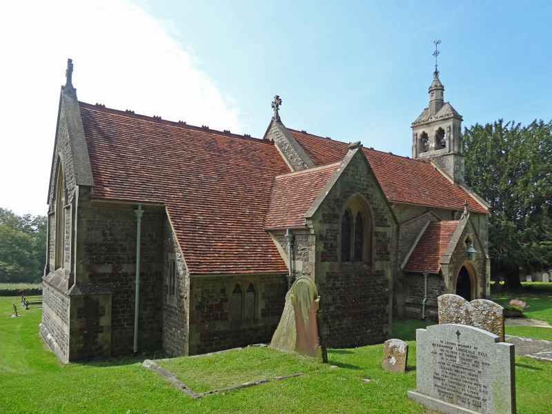
2. Mediaeval traces. Practically rebuilt by Butterfield 1868. Small country church of rubble with red tile roof. C15 style grafted on early English. Chancel, nave and south aisle, west bell turret with 2 bells and odd spirelet. Three bay nave with central gabled porch to north with quatrefoil vent and trefoil heads to side buttresses. Hollow chamfered surround to pointed doorway (possibly C13), wrought iron strap hinges. A 2 and a 3-light square headed Perpendicular style window with mouchette heads. Plain ashlar dressed paired lights to lower later 2 bay chancel with gabled organ vestry to north. Three light geometrical east window (with, inside, a foiled 'rere-arch' - in fact foiled reveal). The west front appears to be a different build: rough-faced rubble with ashlar bands. Central belfry break with 2 foiled openings and crenellated parapet to nipped roof; small octagonal spirelet and weathervane; this break is linked by wall thickening and buttress to small door to south-west with Caernarvon arch. Foiled vesca-shape opening to right. Boiler house and chimney to south-west. Interior: reused plain circa 1200 doorway (now a niche). Low 3 bay arcade, C13. Butterfield reredos, altar-rails, sedilia and pews retained. Nave roof: king post type with foiled braces. Rubble churchyard wall to south and to west, gabled doorway formerly entrance from Abbey. Numerous mediaeval fragments - sculpted stones, mediaeval tiles and some traces of an arcade found during work of 1868, indicating a later church in the Middle Ages.
Listing NGR: SU1361289696
External links are from the relevant listing authority and, where applicable, Wikidata. Wikidata IDs may be related buildings as well as this specific building. If you want to add or update a link, you will need to do so by editing the Wikidata entry.


Other nearby listed buildings