Latitude: 52.2369 / 52°14'12"N
Longitude: -1.8006 / 1°48'1"W
OS Eastings: 413716
OS Northings: 259872
OS Grid: SP137598
Mapcode National: GBR 4L3.MMH
Mapcode Global: VHB09.Q1ZJ
Plus Code: 9C4W65PX+PQ
Entry Name: The Old Vicarage
Listing Date: 11 December 1969
Last Amended: 23 October 1985
Grade: II
Source: Historic England
Source ID: 1184469
English Heritage Legacy ID: 305367
ID on this website: 101184469
Location: Aston Cantlow, Stratford-on-Avon, Warwickshire, B95
County: Warwickshire
District: Stratford-on-Avon
Civil Parish: Aston Cantlow
Traditional County: Warwickshire
Lieutenancy Area (Ceremonial County): Warwickshire
Church of England Parish: Aston Cantlow
Church of England Diocese: Coventry
Tagged with: Clergy house
ASTON CANTLOW CHURCH LANE SP15NW (South side) 7/20 The Old Vicarage 11/12/69 (Formerly listed as The Vicarage)
GV II
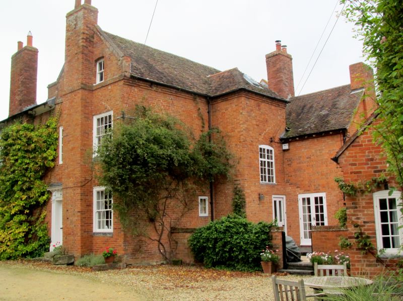
Vicarage, now house. Early C18 and late C18/early C19 ranges. Brick; tile and slate roofs; brick stacks+ Double-depth plan. 2 storeys and 2 storeys and attic; 3-window range. Late C18/early C19 garden front has sashes with moulded frames and gauged brick flat arches. Hipped roof with paired shaped modillions. Entrance in right return side has half-glazed door with arched panels and wood doorcase with boric pilasters, entablature with triglyph frieze and dentils. Irregular fenestration. Early C18 range has coped gable parapet with kneelers and string course at attic level. To rear staircase projection has cross window with glazing bars under segmental brick arch. Early C20 additions. Interior not inspected.
Listing NGR: SP1371659872
External links are from the relevant listing authority and, where applicable, Wikidata. Wikidata IDs may be related buildings as well as this specific building. If you want to add or update a link, you will need to do so by editing the Wikidata entry.


Other nearby listed buildings