Latitude: 55.0176 / 55°1'3"N
Longitude: -1.4215 / 1°25'17"W
OS Eastings: 437088
OS Northings: 569377
OS Grid: NZ370693
Mapcode National: GBR LBJF.14
Mapcode Global: WHD4S.44CS
Plus Code: 9C7W2H9H+2C
Entry Name: 47, Front Street
Listing Date: 19 February 1986
Grade: II
Source: Historic England
Source ID: 1184558
English Heritage Legacy ID: 303306
ID on this website: 101184558
Location: Tynemouth, North Tyneside, Tyne and Wear, NE30
County: North Tyneside
Electoral Ward/Division: Tynemouth
Parish: Non Civil Parish
Built-Up Area: Tynemouth
Traditional County: Northumberland
Lieutenancy Area (Ceremonial County): Tyne and Wear
Church of England Parish: Tynemouth Priory Holy Saviour
Church of England Diocese: Newcastle
Tagged with: Building
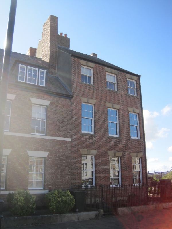
TYNEMOUTH FRONT STREET (south side) NZ 3769 SW Tynemouth 10/60 No. 47 G.V. II House. Circa 1780; later porch. English bond brick with ashlar dressings; Welsh slate roof with stone gable coping. 3 storeys,3 windows and set-back 2-storey right entrance extension. 6-panelled door and overlight in alternate-block jambs under carved lintel, underneath 2 tall sash windows with similar lintels and sloping sills. Entablature and blocking course to extension; first floor string. Main house has sash windows with projecting stone sills and flat stone lintels with false keystones. 2 banded brick chimneys. Included partly for group value.
Listing NGR: NZ3708869377
External links are from the relevant listing authority and, where applicable, Wikidata. Wikidata IDs may be related buildings as well as this specific building. If you want to add or update a link, you will need to do so by editing the Wikidata entry.


Other nearby listed buildings