Latitude: 51.6295 / 51°37'46"N
Longitude: -1.7159 / 1°42'57"W
OS Eastings: 419759
OS Northings: 192341
OS Grid: SU197923
Mapcode National: GBR 4TK.YSK
Mapcode Global: VHC0Q.69QM
Plus Code: 9C3WJ7HM+RJ
Entry Name: Garden House to West of Westhill and Linking Boundary Wall
Listing Date: 20 September 1979
Grade: II
Source: Historic England
Source ID: 1184706
English Heritage Legacy ID: 318370
ID on this website: 101184706
Location: Highworth, Swindon, Wiltshire, SN6
County: Swindon
Civil Parish: Highworth
Built-Up Area: Highworth
Traditional County: Wiltshire
Lieutenancy Area (Ceremonial County): Wiltshire
Church of England Parish: Highworth with Sevenhampton and Inglesham
Church of England Diocese: Bristol
Tagged with: Garden house
1. 5410 HIGHWORTH CRICKLADE ROAD (north side) Garden house to west of Westhill and linking boundary wall SU 19 SE 5/258A
II
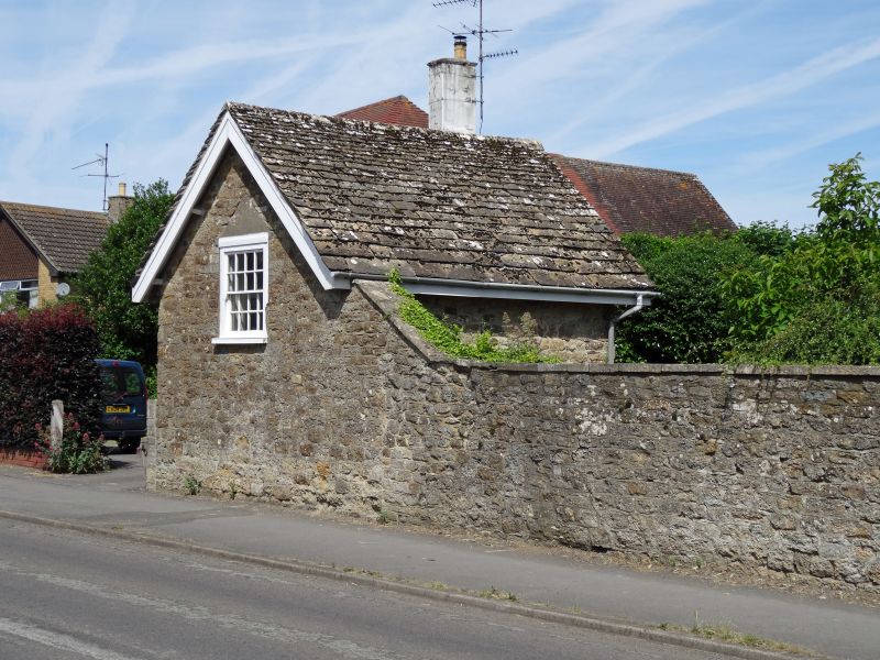
2. Outhouse in south-west corner of garden C19 1 1/2 storeys rubble with stone tile roof. One window to road. Entered from north. Linked to main house by rubble wall about 4 ft high.
Listing NGR: SU1975192337
External links are from the relevant listing authority and, where applicable, Wikidata. Wikidata IDs may be related buildings as well as this specific building. If you want to add or update a link, you will need to do so by editing the Wikidata entry.


Other nearby listed buildings