Latitude: 54.9705 / 54°58'13"N
Longitude: -1.3641 / 1°21'50"W
OS Eastings: 440807
OS Northings: 564169
OS Grid: NZ408641
Mapcode National: GBR LBXZ.G0
Mapcode Global: WHD50.0BQD
Plus Code: 9C6WXJCP+59
Entry Name: Souter Point Lighthouse and Attached Buildings
Listing Date: 26 February 1985
Grade: II*
Source: Historic England
Source ID: 1185593
English Heritage Legacy ID: 303715
Also known as: Souter Point Lighthouse And Attached Buildings 25877;
ID on this website: 101185593
Location: South Tyneside, Tyne and Wear, SR6
County: South Tyneside
Electoral Ward/Division: Whitburn and Marsden
Parish: Non Civil Parish
Traditional County: Durham
Lieutenancy Area (Ceremonial County): Tyne and Wear
Church of England Parish: Whitburn
Church of England Diocese: Durham
Tagged with: Lighthouse
NZ 46SW BOLDON MILL LANE Whitburn
4/55 Souter Point Lighthouse and attached buildings -
GV II*
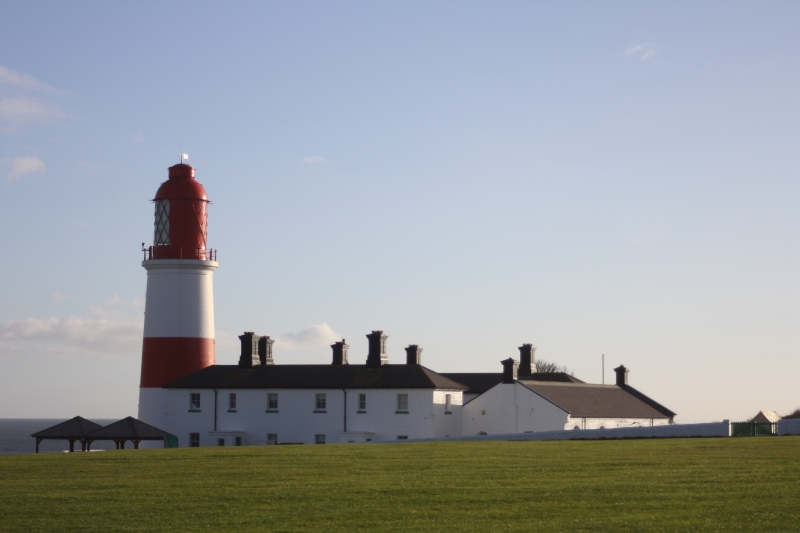
Lighthouse, engine house, boilerhouse, workshops and houses. 1871 by Sir James N Douglas for Trinity House, London. Rendered; Welsh slate roofs. 4 ranges of buildings around a courtyard with the lighthouse connected to the east range. Lighthouse : 75-foot tapered tower with square window openings and at top south a window to allow a light to be seen for entrance to the Wear; overhanging walkway with iron railings around dome-topped lantern of iron. Engine house, boilerhouse and workshops : western one-storey range having central door and 3 windows all round-headed in raised surrounding arches with keystones, garage door and modern door inserted; raised quoins; moulded kneelers supporting painted gable coping; 2 painted square end chimneys. Houses : south, east and north 2-storey ranges each containing 2 houses with projecting square porches having 5-panelled doors in the return; 3 sash windows to each house front, 2 in each west gable joining the one-storey block; raised quoins;. roof with overhanging eaves is hipped, with 2 painted, corniced panelled chimneys to each ridge. A passage of one storey connects the lighthouse to the east range. Historical note : stands on Lizard Point, but to avoid confusion with Cornish Lizard Lighthouse named after Souter Point - next point south. The first lighthouse specifically constructed for electric illumination (carbon arc lamps), after experiments at Dungeness. Original bi-focal lens still in use. Source: D B Hague and R Christie Lighthouses : their architecture, history and archaeology (1975). Llandysul p.160.
Listing NGR: NZ4080764169
External links are from the relevant listing authority and, where applicable, Wikidata. Wikidata IDs may be related buildings as well as this specific building. If you want to add or update a link, you will need to do so by editing the Wikidata entry.


Other nearby listed buildings