Latitude: 52.1092 / 52°6'33"N
Longitude: -1.623 / 1°37'22"W
OS Eastings: 425915
OS Northings: 245716
OS Grid: SP259457
Mapcode National: GBR 5P6.QH3
Mapcode Global: VHBYF.T7BY
Plus Code: 9C4W495G+MR
Entry Name: Grasmere
Listing Date: 13 October 1966
Last Amended: 30 June 1986
Grade: II
Source: Historic England
Source ID: 1185680
English Heritage Legacy ID: 305862
ID on this website: 101185680
Location: Halford, Stratford-on-Avon, Warwickshire, CV36
County: Warwickshire
District: Stratford-on-Avon
Civil Parish: Halford
Built-Up Area: Halford
Traditional County: Warwickshire
Lieutenancy Area (Ceremonial County): Warwickshire
Church of England Parish: Halford
Church of England Diocese: Coventry
Tagged with: Building
HALFORD QUEEN'S STREET SP2545 (East side) 6/99 Grasmere 13/10/66 (Formerly listed as Grasmere Cottage)
GV II
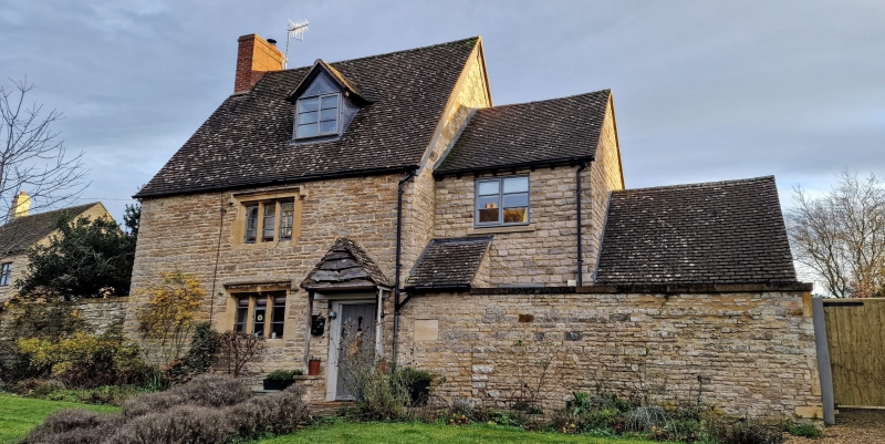
House. Late C17. Finely jointed coursed limestone rubble. Steeply pitched C20 tile roof. Brick end stack to left. Single-unit plan, plus single-storey extension to right. 2 storeys plus attic. Single-window range. Entrance to right has moulded wood door-frame, plank door and gabled C20 porch. Ground floor and first floor each have a 3-light stone-mullioned window with opening lights, hood moulds and label stops. C20 roof dormer. Extension to right has limestone wall to road, brick to right end. Stone slate roof and brick end stack. Interior not inspected.
Listing NGR: SP2591545716
External links are from the relevant listing authority and, where applicable, Wikidata. Wikidata IDs may be related buildings as well as this specific building. If you want to add or update a link, you will need to do so by editing the Wikidata entry.


Other nearby listed buildings