Latitude: 54.488 / 54°29'16"N
Longitude: -1.4932 / 1°29'35"W
OS Eastings: 432928
OS Northings: 510416
OS Grid: NZ329104
Mapcode National: GBR LJ0J.JY
Mapcode Global: WHD78.1G78
Plus Code: 9C6WFGQ4+6P
Entry Name: Public Shelter About 8 Metres South of Numbers 1 and 3 Neasham Hill
Listing Date: 27 January 1988
Grade: II
Source: Historic England
Source ID: 1185937
English Heritage Legacy ID: 350475
ID on this website: 101185937
Location: Neasham, Darlington, County Durham, DL2
County: Darlington
Civil Parish: Neasham
Built-Up Area: Neasham
Traditional County: Durham
Lieutenancy Area (Ceremonial County): County Durham
Church of England Parish: Hurworth
Church of England Diocese: Durham
Tagged with: Architectural structure
NEASHAM NEASHAM HILL
NZ 3210 (North side)
18/119 Public shelter
about 8.0 metres
south of Nos. 1 and
3 Neasham Hill
II
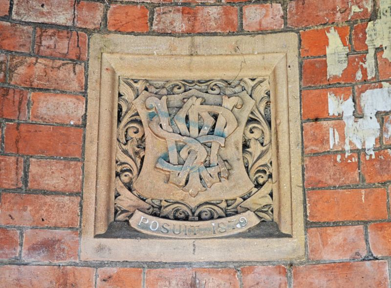
Former pumphouse now public shelter. 1879 for Mr. Ward of Neasham (see plaque
on rear wall). Curved rear wall engineering brick in Flemish bond; sandstone
ashlar responds and pink marble column; plain clay roof tiles. Triangular
plan: 2 open sides with column at angle and curved rear wall. Squat column,
with carved stone capital, on tall shaped base. Chamfered semi-octagonal
responds. Moulded wood beams spanning the open sides. Steeply-pitched roof
is hipped over open sides and is semi-conical above rear wall. Terracotta
finial. Interior: carved stone plaque has shield, monogram SRW (S.R. Ward)
and inscription POSUIT 1879. Radiating tie beams of roof with pendant at
crossing.
Listing NGR: NZ3292810416
External links are from the relevant listing authority and, where applicable, Wikidata. Wikidata IDs may be related buildings as well as this specific building. If you want to add or update a link, you will need to do so by editing the Wikidata entry.


Other nearby listed buildings