Approximate Location Map
Large Map »
Latitude: 51.071 / 51°4'15"N
Longitude: 1.0848 / 1°5'5"E
OS Eastings: 616205
OS Northings: 134713
OS Grid: TR162347
Mapcode National: GBR V0L.YW4
Mapcode Global: FRA F659.0FY
Plus Code: 9F3333CM+CW
Entry Name: 6, Marine Walk Street
Listing Date: 21 December 1973
Grade: II
Source: Historic England
Source ID: 1186180
English Heritage Legacy ID: 175151
ID on this website: 101186180
Location: Hythe, Folkestone and Hythe, Kent, CT21
County: Kent
District: Folkestone and Hythe
Civil Parish: Hythe
Built-Up Area: Hythe
Traditional County: Kent
Lieutenancy Area (Ceremonial County): Kent
Tagged with: Building
1.
1253 MARINE WALK STREET
(West Side)
No 6
TR 1634 NW 2/118
II GV
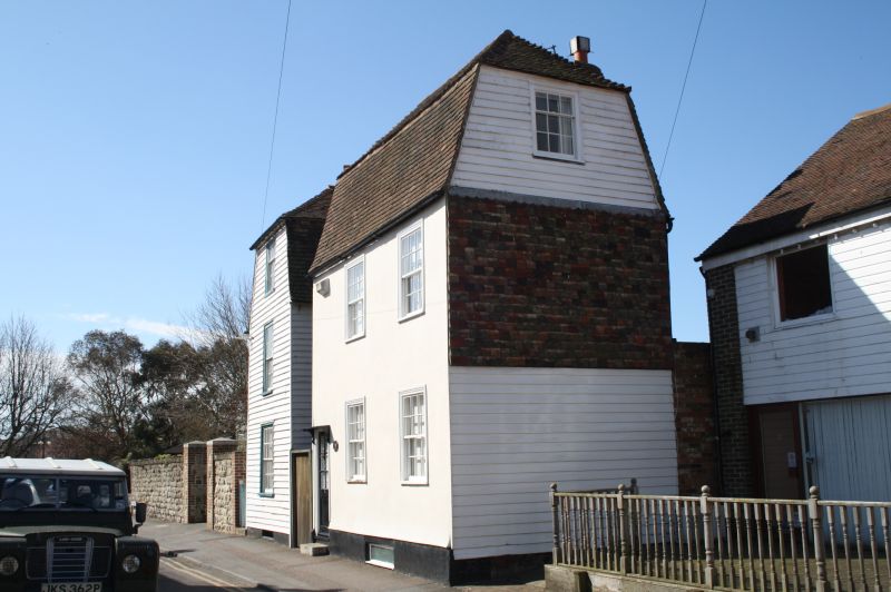
2.
Late C18. 2 storeys and attics stuccoed. Weatherboarded on side elevation.
Tiled mansard roof. 2 sashes with verticals only on 1st floor. Left side simple
doorcase with vestigial wooden weather hood on brackets.
Nos 6 and 8 form a group.
Listing NGR: TR1620534713
External links are from the relevant listing authority and, where applicable, Wikidata. Wikidata IDs may be related buildings as well as this specific building. If you want to add or update a link, you will need to do so by editing the Wikidata entry.


Other nearby listed buildings
