Latitude: 51.787 / 51°47'13"N
Longitude: -2.4509 / 2°27'3"W
OS Eastings: 368996
OS Northings: 209906
OS Grid: SO689099
Mapcode National: GBR FY.YLP0
Mapcode Global: VH875.GBPZ
Plus Code: 9C3VQGPX+QM
Entry Name: Dock and Lock Walls at Bullo Pill
Listing Date: 25 January 1985
Grade: II
Source: Historic England
Source ID: 1186404
English Heritage Legacy ID: 353949
ID on this website: 101186404
Location: Bullo, Forest of Dean, Gloucestershire, GL14
County: Gloucestershire
District: Forest of Dean
Civil Parish: Newnham
Traditional County: Gloucestershire
Lieutenancy Area (Ceremonial County): Gloucestershire
Church of England Parish: Newnham St Peter
Church of England Diocese: Gloucester
Tagged with: Lock
SO 60 NE NEWNHAM BULLO PILL
3/1 Dock and Lock walls at Bullo Pill - - II
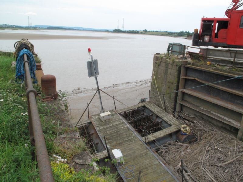
Dock and lock walls. C19. Heavy sandstone squared and dressed with very large bull-nosed coping blocks. At river edge, walling rises c.6 m from mud level (variable), and c.40 m southward from dock opening, but dying out to damaged end, returns c.90 m to west, on south side of dock and lock, of which c.54 m is well-formed lock and -entrance walling, stepping down to lower containing wall which dies into grass at west end. Measurements are all approximate, and taken only to south bank of dock; north bank corresponds for first c.54 m westwards from river edge and remains in part buried in later grass and other growth to west. This is an important remnant of the former trade routes in and across the Severn. The dock gates remain only in fragmentary form at the time of survey.
Listing NGR: SO6899609906
External links are from the relevant listing authority and, where applicable, Wikidata. Wikidata IDs may be related buildings as well as this specific building. If you want to add or update a link, you will need to do so by editing the Wikidata entry.


Other nearby listed buildings