Approximate Location Map
Large Map »
Latitude: 51.6967 / 51°41'48"N
Longitude: -2.2219 / 2°13'18"W
OS Eastings: 384760
OS Northings: 199796
OS Grid: ST847997
Mapcode National: GBR 1N4.H38
Mapcode Global: VH954.FMQ5
Plus Code: 9C3VMQWH+M6
Entry Name: Damery House
Listing Date: 17 July 1980
Grade: II
Source: Historic England
Source ID: 1186717
English Heritage Legacy ID: 354725
ID on this website: 101186717
Location: Egypt, Stroud, Gloucestershire, GL6
County: Gloucestershire
District: Stroud
Civil Parish: Nailsworth
Built-Up Area: Nailsworth
Traditional County: Gloucestershire
Lieutenancy Area (Ceremonial County): Gloucestershire
Church of England Parish: Nailsworth St George
Church of England Diocese: Gloucester
Tagged with: House
SPRING HILL
1.
5227
(north-east side)
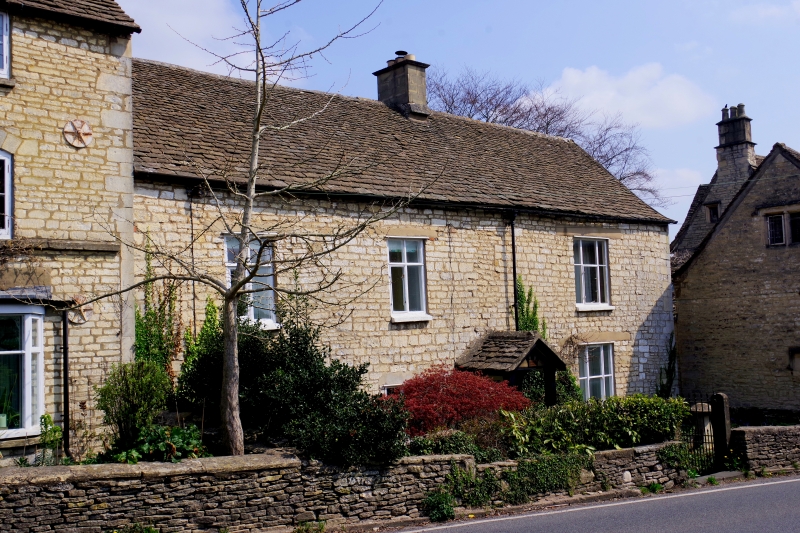
Damery House
ST 8499 6/128A
II GV
2.
Early to mid C19. Two storeys, rubble with stone tile roof. Two+one
windows, casements. Central gabled wooden porch.
Included for group value.
Listing NGR: ST8476099796
External links are from the relevant listing authority and, where applicable, Wikidata. Wikidata IDs may be related buildings as well as this specific building. If you want to add or update a link, you will need to do so by editing the Wikidata entry.


Other nearby listed buildings
