Latitude: 51.3313 / 51°19'52"N
Longitude: 0.0028 / 0°0'10"E
OS Eastings: 539625
OS Northings: 161039
OS Grid: TQ396610
Mapcode National: GBR LB.Z8L
Mapcode Global: VHHP9.0SBS
Plus Code: 9F3282J3+G4
Entry Name: Coal Taxpost 100 Yards South of Junction with Sheepbarn Lane
Listing Date: 20 September 1985
Grade: II
Source: Historic England
Source ID: 1186819
English Heritage Legacy ID: 358630
ID on this website: 101186819
Location: Fickleshole, Croydon, London, CR6
County: London
District: Croydon
Electoral Ward/Division: New Addington
Parish: Non Civil Parish
Built-Up Area: New Addington
Traditional County: Surrey
Lieutenancy Area (Ceremonial County): Greater London
Church of England Parish: West Wickham St John
Church of England Diocese: Southwark
Tagged with: Coal-tax post
SKIDHILL 1. (West Side) 4407 Coal Taxpost 100 yards TQ 36 SE (395613) 13/1 south of junction with Sheepbarn Lane II
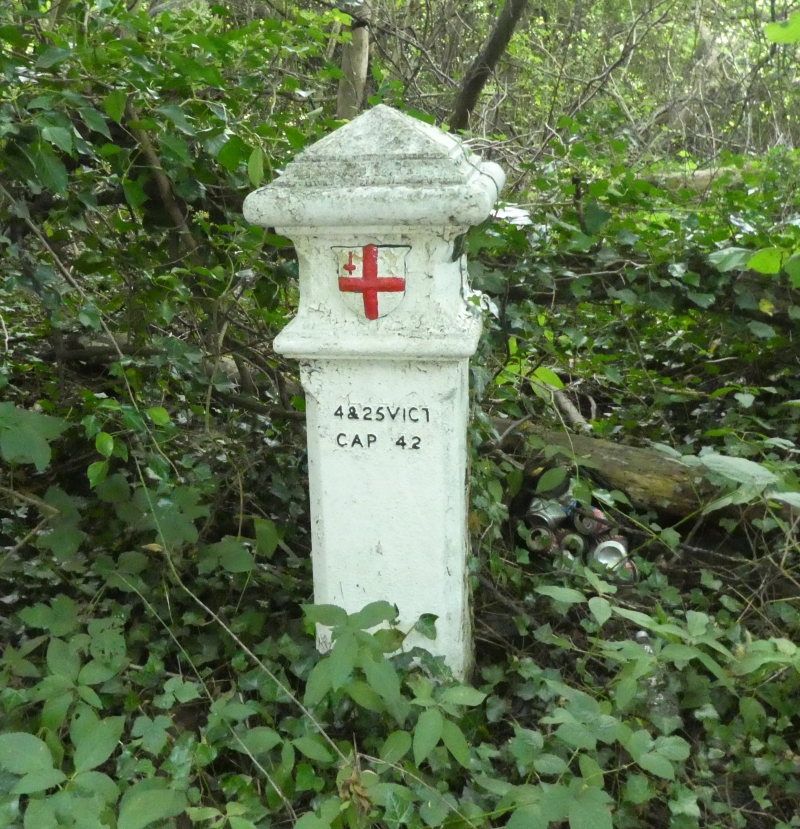
Coal Taxpost. 1861. Cast iron. Square with chamfered sides and moulded caps, bearing shield from the City's Arms. Classified as No 184 type 2d in The Coal Duties of the City of London and their Boundary Marks (1972). Martin Nail.
Listing NGR: TQ3962561039
External links are from the relevant listing authority and, where applicable, Wikidata. Wikidata IDs may be related buildings as well as this specific building. If you want to add or update a link, you will need to do so by editing the Wikidata entry.


Other nearby listed buildings