Latitude: 52.8177 / 52°49'3"N
Longitude: -0.8096 / 0°48'34"W
OS Eastings: 480322
OS Northings: 325123
OS Grid: SK803251
Mapcode National: GBR CPR.657
Mapcode Global: WHFJV.JFPR
Plus Code: 9C4XR59R+35
Entry Name: 2 and 3, Church Lane
Listing Date: 11 September 1979
Grade: II
Source: Historic England
Source ID: 1188830
English Heritage Legacy ID: 190328
ID on this website: 101188830
Location: Waltham on the Wolds, Melton, Leicestershire, LE14
County: Leicestershire
District: Melton
Civil Parish: Waltham on the Wolds and Thorpe Arnold
Built-Up Area: Waltham on the Wolds
Traditional County: Leicestershire
Lieutenancy Area (Ceremonial County): Leicestershire
Church of England Parish: Waltham-on-the-Wolds
Church of England Diocese: Leicester
Tagged with: Building
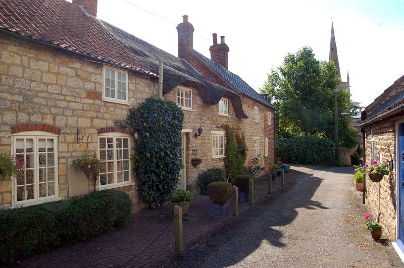
WALTHAM CHURCH LANE SK 8025 (East side) 30/400 Nos 2 and 3 11.9.79 II Pair of cottages, now house. C17 and C18, altered C20. Coursed limestone rubble, thatch and pantile roofs, brick ridge stacks. One-unit plans originally. 2-storey, 4-window range. C20 door to right of centre with wood lintel. Irregular glazing of 2-light casement windows, that to ground floor far left with chamfered stone lintel of probable former stone mullion window, that to 1st floor far left and those to 1st floor right of centre in eyebrow dormers. Interior noted as having chamfered spine beams.
Listing NGR: SK8032225123
External links are from the relevant listing authority and, where applicable, Wikidata. Wikidata IDs may be related buildings as well as this specific building. If you want to add or update a link, you will need to do so by editing the Wikidata entry.


Other nearby listed buildings