Latitude: 51.6671 / 51°40'1"N
Longitude: -0.0706 / 0°4'14"W
OS Eastings: 533530
OS Northings: 198244
OS Grid: TQ335982
Mapcode National: GBR H4.QVB
Mapcode Global: VHGQ7.QCKB
Plus Code: 9C3XMW8H+RQ
Entry Name: Stable Building to the Hermitage the Hermitage
Listing Date: 19 March 1951
Grade: II*
Source: Historic England
Source ID: 1189040
English Heritage Legacy ID: 200622
ID on this website: 101189040
Location: Forty Hill, Enfield, London, EN2
County: London
District: Enfield
Electoral Ward/Division: Chase
Parish: Non Civil Parish
Built-Up Area: Enfield
Traditional County: Middlesex
Lieutenancy Area (Ceremonial County): Greater London
Church of England Parish: Jesus Church Forty Hill
Church of England Diocese: London
1. 4411 FORTY HILL (North-west Side) 19.3.51. The Hermitage Stable building to The Hermitage TQ 3398 3/143
II* GV
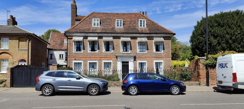
2. Late C17 or early C18 house of 2 storeys and attic, 6 windows. High pitched hipped tiled roof with 3 dormers. Wood modillion eaves cornice. Dark red brick with lst floor band. Gauged brick arches to sash windows with glazing bars in exposed moulded frames. Later blind cases. Near-central doorcase has rusticated pilasters, entablature and dentilled cornice hood broken back in centre. Date 1704 on North end. Inside all the rooms of the front part have original panelling with dado rail; there is a staircase with thick turned balusters and closed string; and all back rooms have C17 square panelling. At back left a timber-framed weatherboarded stable building of 2 storeys and attic, 2 windows. Steep tiled roof. Pointed windows above, stable doors below.
Nos 70 to 76 (even) form a group with The Hermitage and Stable Building attached and its forecourt walls.
Listing NGR: TQ3353098244
External links are from the relevant listing authority and, where applicable, Wikidata. Wikidata IDs may be related buildings as well as this specific building. If you want to add or update a link, you will need to do so by editing the Wikidata entry.


Other nearby listed buildings