Latitude: 51.24 / 51°14'24"N
Longitude: -0.0133 / 0°0'47"W
OS Eastings: 538781
OS Northings: 150856
OS Grid: TQ387508
Mapcode National: GBR KKL.3HB
Mapcode Global: VHGSD.Q3B7
Plus Code: 9C3X6XRP+2M
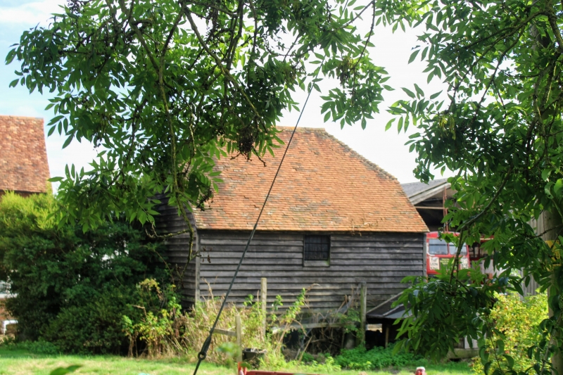
Entry Name: Granary 10 Yards to West of Perrysfield Farmhouse
Listing Date: 11 June 1958
Last Amended: 8 November 1999
Grade: II
Source: Historic England
Source ID: 1189584
English Heritage Legacy ID: 287874
ID on this website: 101189584
Location: Tandridge, Surrey, RH8
County: Surrey
District: Tandridge
Civil Parish: Oxted
Traditional County: Surrey
Lieutenancy Area (Ceremonial County): Surrey
Church of England Parish: Hurst Green St John the Evangelist
Church of England Diocese: Southwark
Tagged with: Granary
TQ 35 SE
303/6/221
11.06.1958
OXTED
GIBBS BROOK LANE
Granary 10yds to west of Perrysfield Farmhouse
GV
II
Granary. Late C18. Timber framed on staddlestones, weatherboard cladding with half hipped plain tiled roof. Rectangular planked door on centre of south face.
Interior: 3 framed bays with Queen strut-trusses.
Listing NGR: TQ3878150856
External links are from the relevant listing authority and, where applicable, Wikidata. Wikidata IDs may be related buildings as well as this specific building. If you want to add or update a link, you will need to do so by editing the Wikidata entry.


Other nearby listed buildings