Latitude: 52.2233 / 52°13'23"N
Longitude: -0.7432 / 0°44'35"W
OS Eastings: 485947
OS Northings: 259090
OS Grid: SP859590
Mapcode National: GBR CXZ.QWF
Mapcode Global: VHDS8.2CGY
Plus Code: 9C4X67F4+8P
Entry Name: Threefold
Listing Date: 16 June 1972
Last Amended: 6 September 1988
Grade: II
Source: Historic England
Source ID: 1189931
English Heritage Legacy ID: 235451
ID on this website: 101189931
Location: Castle Ashby, West Northamptonshire, NN7
County: West Northamptonshire
Civil Parish: Castle Ashby
Traditional County: Northamptonshire
Lieutenancy Area (Ceremonial County): Northamptonshire
Church of England Parish: Castle Ashby St Mary Magdalene
Church of England Diocese: Peterborough
Tagged with: Building
CASTLE ASHBY CASTLE ASHBY VILLAGE SP8559 12/52 No.47 (Threefold) 16/06/72 (Formerly listed as Schoolroom and school house)
- II
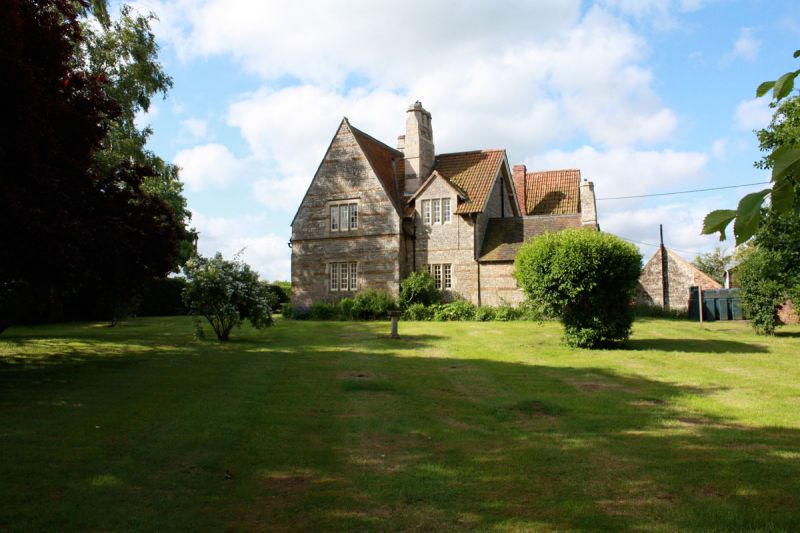
School and school house, now offices. By G.E. Street. 1856, with later C19 extension. Coursed squared limestone banded with ironstone, plain-tile roof, stone lateral and ridge stacks.L-plan,lstor,ry and attic, 3-window range. Chamfered pointed arched doorway to right of centre with alternate limestone and ironstone blocks to head, part-glazed plank door with ornamental hinge and hood mould. 2-light chamfered stone mullion window to right of doorway and similar 3-light windows flanking large projecting lateral stack to left of centre. Hipped dormer with similar 2-light window to right of centre. Plinth with batter and stone-coped gables with kneelers. Wings to left and right of centre, that to left probably a later addition. Interior not inspected. (Buildings of England: Northamptonshire: 1973, p145)
Listing NGR: SP8594759090
External links are from the relevant listing authority and, where applicable, Wikidata. Wikidata IDs may be related buildings as well as this specific building. If you want to add or update a link, you will need to do so by editing the Wikidata entry.


Other nearby listed buildings