Latitude: 53.9876 / 53°59'15"N
Longitude: -1.5265 / 1°31'35"W
OS Eastings: 431146
OS Northings: 454723
OS Grid: SE311547
Mapcode National: GBR KQSB.B9
Mapcode Global: WHC8M.J1BB
Plus Code: 9C5WXFQF+3C
Entry Name: Bede House (St. Aidans C Of E High School)
Listing Date: 4 February 1975
Grade: II
Source: Historic England
Source ID: 1190261
English Heritage Legacy ID: 329955
ID on this website: 101190261
Location: High Harrogate, North Yorkshire, HG2
County: North Yorkshire
District: Harrogate
Electoral Ward/Division: Stray
Parish: Harrogate
Built-Up Area: Harrogate
Traditional County: Yorkshire
Lieutenancy Area (Ceremonial County): North Yorkshire
Church of England Parish: High Harrogate Christ Church
Church of England Diocese: Leeds
Tagged with: Architectural structure
This list entry was subject to a Minor Amendment on 13 February 2024 to amend the name, address and reformat the text to current standards
SE 3154
27/30
OATLANDS DRIVE
Bede House (St. Aidans C Of E High School)
(Formerly listed as SLINGSBY WALK Oatlahds (Harrowgate Wheatland County Secondary School))
II
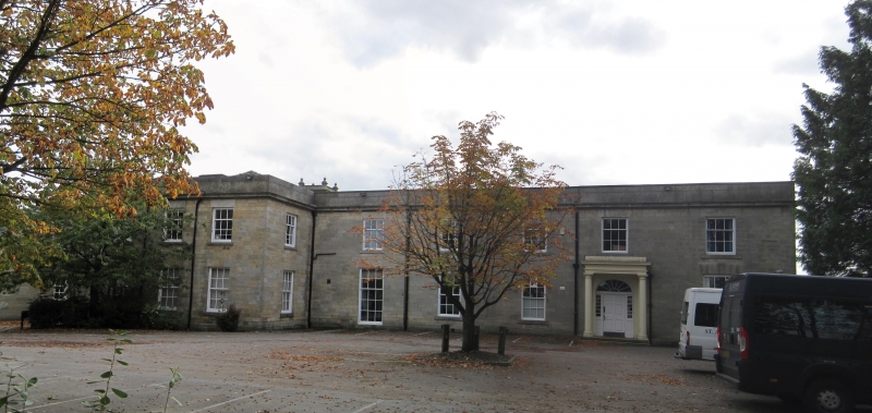
Early C19 house. Two storeys. Five window frontage with projecting three window wing at north-east end. Grit stone ashlar with cornice and parapet. Slate roof. Slightly recessed sash windows with glazing bars and shutters. Plain Tuscan prostyle portico with semi-elliptical arched doorway with sidelights, panelled door and radial fanlight. Later additions at rear incorporating former stable clock tower of three stages with finials over corner pilasters.
Listing NGR: SE3114654723
External links are from the relevant listing authority and, where applicable, Wikidata. Wikidata IDs may be related buildings as well as this specific building. If you want to add or update a link, you will need to do so by editing the Wikidata entry.


Other nearby listed buildings