Latitude: 54.0209 / 54°1'15"N
Longitude: -1.2182 / 1°13'5"W
OS Eastings: 451316
OS Northings: 458608
OS Grid: SE513586
Mapcode National: GBR MPYY.1C
Mapcode Global: WHD9Q.8649
Plus Code: 9C6W2QCJ+9P
Entry Name: Pump House Approximately 250 Metres to West North West of Hall
Listing Date: 20 October 1986
Grade: II
Source: Historic England
Source ID: 1190577
English Heritage Legacy ID: 332100
ID on this website: 101190577
Location: North Yorkshire, YO30
County: North Yorkshire
District: Hambleton
Civil Parish: Beningbrough
Traditional County: Yorkshire
Lieutenancy Area (Ceremonial County): North Yorkshire
Church of England Parish: Newton-on-Ouse All Saints
Church of England Diocese: York
Tagged with: Pump
SE 55 NW BENINGBROUGH BENINGBROUGH HALL
4/7 Pump House approx 250m to west-north-west of - hall. GV II
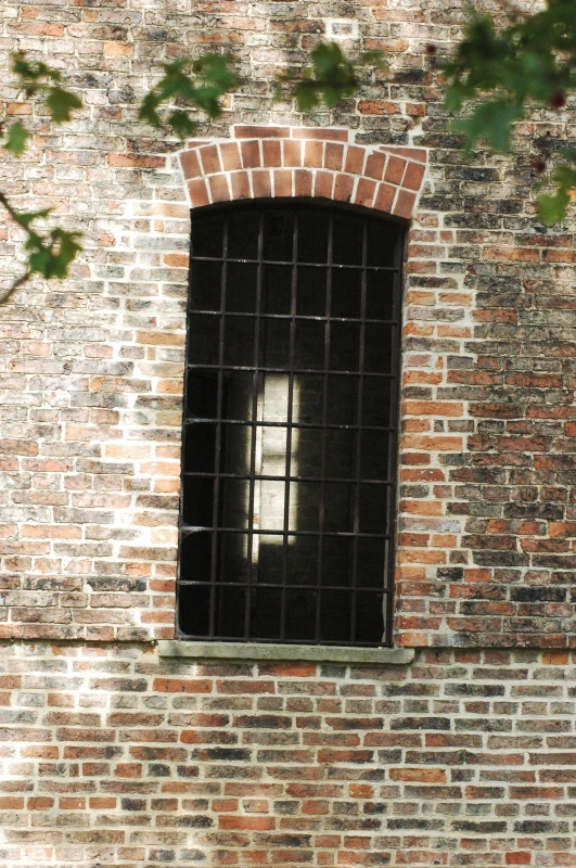
Pump house. Late c19-early C20. For the Dawnays of Beningbrough Hall. Brick, some reused, thin and orange, the rest mottled pink in English garden wall bond with contrasting white brick; stone dressings. Square on plan with outshut to west. 3 stages with embattled parapet. White-brick clasping butresses. East elevation: central doorway under cambered header brick arch with 5-course band above. Stone band. 2nd stage: 3 narrow windows with chamfered stone lintels, stone cills and brick relieving arches separated by white-brick pilasters which rise into stepped and dentilled cornice. 3rd stage: 3 narrow windows with chamfered lintels. Corbelled parapet. West elevation: opposing elliptical-arched doorway masked by outshut (roof removed). Windows as east elevation. North elevation: lst stage window has remains of iron glazing bars. Interior: massive timber ties. Pumped water from the River Ouse up to a skating pond (q.v.). In state of dereliction at time of resurvey. This presumably replaced an earlier pump house marked on the 6" Ordnance Survey map of 1852 (1st edition, Yorkshire Sheet 156).
Listing NGR: SE5131658608
External links are from the relevant listing authority and, where applicable, Wikidata. Wikidata IDs may be related buildings as well as this specific building. If you want to add or update a link, you will need to do so by editing the Wikidata entry.


Other nearby listed buildings