Latitude: 52.8464 / 52°50'46"N
Longitude: -1.6523 / 1°39'8"W
OS Eastings: 423517
OS Northings: 327708
OS Grid: SK235277
Mapcode National: GBR 5D8.H32
Mapcode Global: WHCFZ.LQF8
Plus Code: 9C4WR8WX+G3
Entry Name: School and Attached House Approximately 100M West of Church of St Mary
Listing Date: 26 March 1986
Grade: II
Source: Historic England
Source ID: 1190728
English Heritage Legacy ID: 273645
ID on this website: 101190728
Location: Rolleston on Dove, East Staffordshire, DE13
County: Staffordshire
District: East Staffordshire
Civil Parish: Rolleston on Dove
Built-Up Area: Rolleston on Dove
Traditional County: Staffordshire
Lieutenancy Area (Ceremonial County): Staffordshire
Church of England Parish: Rolleston St Mary
Church of England Diocese: Lichfield
Tagged with: School building
ROLLESTON C.P. CHURCH ROAD SK 22 NW School and attached 11/66 - house approximately l00m west of Church of St Mary GV II
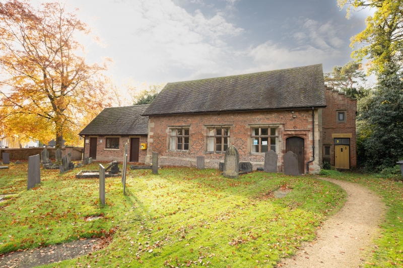
School house. C17 raised and reroofed in the late C19 with additions. Red brick with stone quoins and dressings. Single storey on plinth; 3-window front; 3-light stone cavetto mullions and transomes labelled, the label of the right window is continued and stepped down over a Tudor-arched doorway against the right end of the building. The quoins on the left end have 2 inscribed panels "T.L./S.T." visible in the lower and "THOMAS ... SEV...." in the upper. Attached wing to rear with C20 twin-shafted Tudor-style stacks, entrance elevation painted white, segmental-headed C19 casements.
Listing NGR: SK2352327705
External links are from the relevant listing authority and, where applicable, Wikidata. Wikidata IDs may be related buildings as well as this specific building. If you want to add or update a link, you will need to do so by editing the Wikidata entry.


Other nearby listed buildings