Approximate Location Map
Large Map »
Latitude: 52.481 / 52°28'51"N
Longitude: -0.4714 / 0°28'17"W
OS Eastings: 503907
OS Northings: 288101
OS Grid: TL039881
Mapcode National: GBR FXX.FN1
Mapcode Global: VHFNH.SW4Z
Plus Code: 9C4XFGJH+9C
Entry Name: 39A, West Street
Listing Date: 7 June 1974
Grade: II
Source: Historic England
Source ID: 1191198
English Heritage Legacy ID: 231805
ID on this website: 101191198
Location: Oundle, North Northamptonshire, PE8
County: North Northamptonshire
Civil Parish: Oundle
Built-Up Area: Oundle
Traditional County: Northamptonshire
Lieutenancy Area (Ceremonial County): Northamptonshire
Church of England Parish: Oundlew Ashton
Church of England Diocese: Peterborough
Tagged with: Building
1.
1483
TL 0388
1/168
WEST STREET
(North Side)
No 39A
II
GV
2.
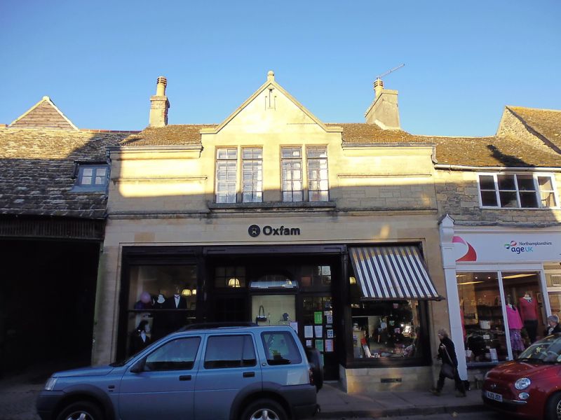
Probably C18. 2 storeys in stone. Stone slate roof, One 4-light modern window
on 1st floor. Late C19 shop front. Included as part of a group.
Nos 15 to 19 (odd) 25 and 33 to 53 (odd) form a group with Church of St Wilfred,
Paine's Almshousese and Oundle Congreational Church.
Listing NGR: TL0390788101
External links are from the relevant listing authority and, where applicable, Wikidata. Wikidata IDs may be related buildings as well as this specific building. If you want to add or update a link, you will need to do so by editing the Wikidata entry.


Other nearby listed buildings
