Latitude: 51.0602 / 51°3'36"N
Longitude: -0.3304 / 0°19'49"W
OS Eastings: 517099
OS Northings: 130311
OS Grid: TQ170303
Mapcode National: GBR HJN.F95
Mapcode Global: FRA B669.TB6
Plus Code: 9C3X3M69+3R
Entry Name: Churchyard and Vicarage Wall and Gate Piers
Listing Date: 26 July 1974
Grade: II
Source: Historic England
Source ID: 1191613
English Heritage Legacy ID: 298127
ID on this website: 101191613
Location: Horsham, West Sussex, RH12
County: West Sussex
District: Horsham
Electoral Ward/Division: Denne
Parish: Horsham
Built-Up Area: Horsham
Traditional County: Sussex
Lieutenancy Area (Ceremonial County): West Sussex
Church of England Parish: Horsham St Mary the Virgin
Church of England Diocese: Chichester
Tagged with: Churchyard
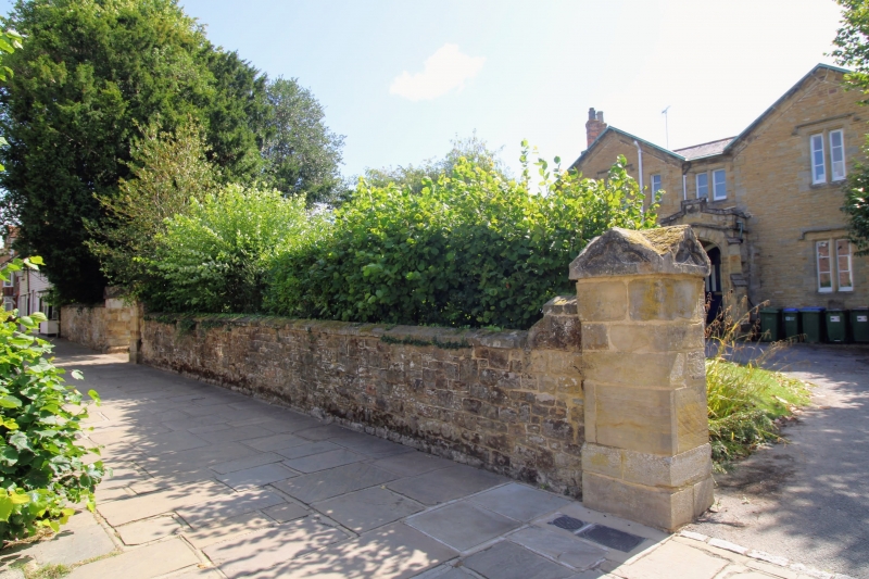
THE CAUSEWAY 1. 1236 (East Side) Churchyard and Vicarage Wall & Gate-piers TQ 1730 1/12A II GV 2. At south end of Causeway are 2 large churchyard gate-piers (now without gates). The piers have moulded bases, rusticated panels and entablatures bearing 2 cast-iron lamps (that to west pier is now missing). Also 2 cast-iron columns, one fluted, guard the pedestrian entrance to the churchyard. From the east gate-pier of the churchyard a stone wall runs north-east enclosing the open spaces around the church, and providing continuity between the buildings in the Causeway and the church. The wall is of random stone with dressed stone cappings. Probably C19. 2 pairs of gatepiers remain with square stone cappings, some with gabled tops containing trefoils, and all with moulded plinths. All the listed buildings in The Causeway form a very important group with all the listed buildings in Market Square and with South Street.
Listing NGR: TQ1710130312
External links are from the relevant listing authority and, where applicable, Wikidata. Wikidata IDs may be related buildings as well as this specific building. If you want to add or update a link, you will need to do so by editing the Wikidata entry.


Other nearby listed buildings