Latitude: 51.6527 / 51°39'9"N
Longitude: -0.2047 / 0°12'16"W
OS Eastings: 524298
OS Northings: 196401
OS Grid: TQ242964
Mapcode National: GBR BZ.F2V
Mapcode Global: VHGQ5.DQNF
Plus Code: 9C3XMQ3W+34
Entry Name: Former Victoria Maternity Hospital
Listing Date: 7 April 1983
Grade: II
Source: Historic England
Source ID: 1192582
English Heritage Legacy ID: 199159
ID on this website: 101192582
Location: Chipping Barnet, Barnet, London, EN5
County: London
District: Barnet
Electoral Ward/Division: Underhill
Parish: Non Civil Parish
Built-Up Area: Barnet
Traditional County: Hertfordshire
Lieutenancy Area (Ceremonial County): Greater London
Church of England Parish: Chipping Barnet
Church of England Diocese: St.Albans
Tagged with: Hospital building
This list entry was subject to a Minor Amendment on 29 January 2025 to update the name and address and reformat the text to current standards
TQ 2496
10/46
CATTLEY CLOSE
Former Victoria Maternity Hospital
(Formerly listed as WOOD STREET (south side) Victoria Maternity Hospital (No 55)
GV
II
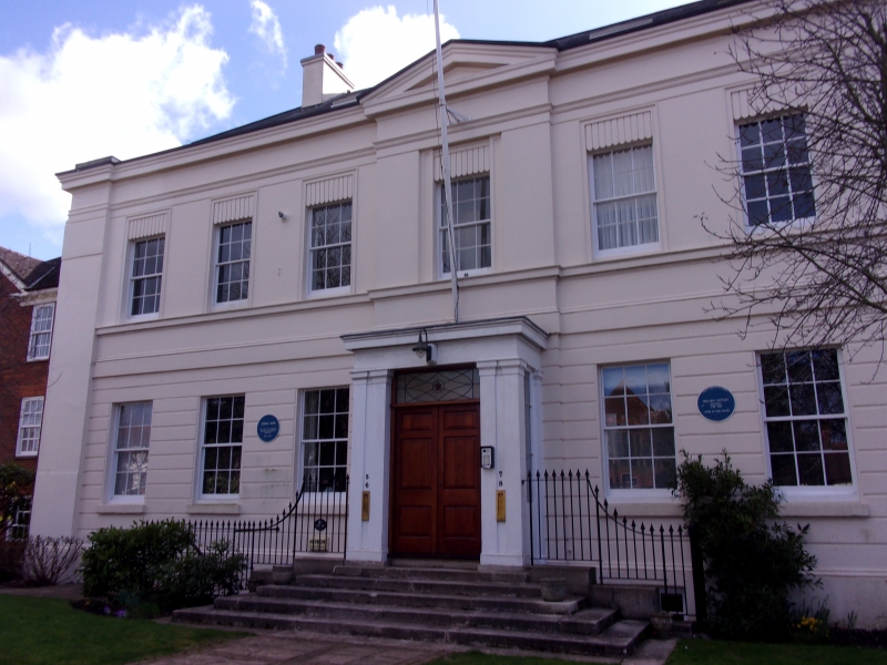
Three bay C18 house with early C19 stucco refronting to form seven bay symmetrical facade.
Two storeys. Sash windows with glazing bars. Much flat moulding; drafting to ground storey; framing pilaster strips. Centre bay slightly broken forward under pediment with coupled pilaster porch below. Parapet with cornice. C18 roof with slates. Three storey canted bay on rear elevation.
Listing NGR: TQ2429896401
External links are from the relevant listing authority and, where applicable, Wikidata. Wikidata IDs may be related buildings as well as this specific building. If you want to add or update a link, you will need to do so by editing the Wikidata entry.


Other nearby listed buildings