Latitude: 53.0298 / 53°1'47"N
Longitude: -1.0314 / 1°1'53"W
OS Eastings: 465053
OS Northings: 348491
OS Grid: SK650484
Mapcode National: GBR 9J8.41D
Mapcode Global: WHFHS.433N
Plus Code: 9C5W2XH9+WC
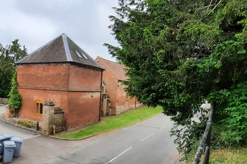
Entry Name: Pigeoncote and Attached Gateways, Barn and Wall at Epperstone Manor
Listing Date: 11 August 1961
Grade: II
Source: Historic England
Source ID: 1193629
English Heritage Legacy ID: 242099
ID on this website: 101193629
Location: Epperstone, Newark and Sherwood, Nottinghamshire, NG14
County: Nottinghamshire
District: Newark and Sherwood
Civil Parish: Epperstone
Built-Up Area: Epperstone
Traditional County: Nottinghamshire
Lieutenancy Area (Ceremonial County): Nottinghamshire
Church of England Parish: Epperstone
Church of England Diocese: Southwell and Nottingham
Tagged with: Dovecote
SK 64 NE EPPERSTONE MAIN STREET (south side)
9/43 Pigeoncote and attached gateways, barn and wall at 11.8.61 Epperstone Manor G.V. II
Pigeoncote and attached gateways, barn and wall. Early C18, late C18, late C19. Red brick and ashlar. Early C18 pigeoncote. Red brick. Pyramidal plain tile roof. First floor band. Rear with doorway with chamfered flush ashlar quoin surround and plank door. Above is a single panel with raised brick surround and 2 rows of openings for birds. Attached to the left is a C19 restored coped ashlar wall extending for a single metre with ashlar pier and pyramidal shaped coping. Central double iron gate, having a similar single pier to the left, the wall further left is set on a plinth and extends for 2 metres, being broken by a chamfered arched doorway with plank door, the wall is higher over the doorway. to the right of the pigeoncote is a C19 ashlar gateway. Decorative iron gate in chamfered arched surround, moulded spandrels and Tudor style hood mould. Either side are single stepped buttresses. The wall over the gateway is stepped with shaped coping, the central section rising to form a gable. In the apex is a segmental pointed arched panel decorated with coat of arms. Attached to the right is the late C18 red brick and pantile barn. Set on a rubble plinth. Dentil eaves. Doorway with plank door, with single opening above right. 4 cross tie plates. Attached to the right is a red brick wall with rock face ashlar coping, this extends for 22 metres.
Listing NGR: SK6505348491
External links are from the relevant listing authority and, where applicable, Wikidata. Wikidata IDs may be related buildings as well as this specific building. If you want to add or update a link, you will need to do so by editing the Wikidata entry.


Other nearby listed buildings