Approximate Location Map
Large Map »
Latitude: 51.2052 / 51°12'18"N
Longitude: -2.1821 / 2°10'55"W
OS Eastings: 387371
OS Northings: 145128
OS Grid: ST873451
Mapcode National: GBR 1V6.749
Mapcode Global: VH97H.4Y7Y
Plus Code: 9C3V6R49+34
Entry Name: 14-18, High Street
Listing Date: 31 March 1978
Grade: II
Source: Historic England
Source ID: 1194032
English Heritage Legacy ID: 312923
ID on this website: 101194032
Location: Warminster, Wiltshire, BA12
County: Wiltshire
Civil Parish: Warminster
Built-Up Area: Warminster
Traditional County: Wiltshire
Lieutenancy Area (Ceremonial County): Wiltshire
Church of England Parish: Warminster St Denys
Church of England Diocese: Salisbury
Tagged with: Building
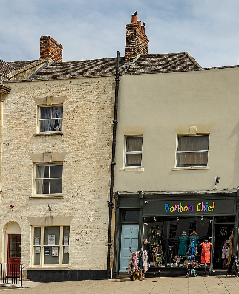
WARMINSTER HIGH STREET
1.
5411
(North Side)
Nos 14 to 18 (even)
ST 8745 SW 6/236
II GV
2.
Early C19 front of painted brick with stone coping in 2 builds; Nos 14 and
16 2 storeys, No 18 3 storeys, over basements, but cope and ridge height continuous.
Tiled roof hipped to right, one brick ridge chimney.
Nos 14 and 16 2 first floor windows (with stone lintels and keys). Early
C20 shop front altered to allow entrance from right and entrance to house
left, framed by 3 panelled pilaster strips.
No 18: One range of windows, late glazed sashes on 1st and 2nd floors, and
in casement on the ground floor. Round headed doorway to left.
Listing NGR: ST8737645133
External links are from the relevant listing authority and, where applicable, Wikidata. Wikidata IDs may be related buildings as well as this specific building. If you want to add or update a link, you will need to do so by editing the Wikidata entry.


Other nearby listed buildings
