Latitude: 51.6498 / 51°38'59"N
Longitude: -1.2657 / 1°15'56"W
OS Eastings: 450901
OS Northings: 194815
OS Grid: SU509948
Mapcode National: GBR 7YY.JTY
Mapcode Global: VHCY7.0SRL
Plus Code: 9C3WJPXM+WP
Entry Name: Sutton Bridge and Causeways (That Part in Culham Civil Parish)
Listing Date: 18 July 1963
Last Amended: 16 March 1987
Grade: II
Source: Historic England
Source ID: 1194571
English Heritage Legacy ID: 248827
ID on this website: 101194571
Location: Culham, South Oxfordshire, OX14
County: Oxfordshire
District: South Oxfordshire
Civil Parish: Culham
Built-Up Area: Culham
Traditional County: Oxfordshire
Lieutenancy Area (Ceremonial County): Oxfordshire
Church of England Parish: Culham
Church of England Diocese: Oxford
CULHAM TOLLGATE ROAD SU5094 12/42 Sutton Bridge and causeways 18/07/63 (that part in Culham C.P.) (Formerly listed as Sutton Bridge)
GV II
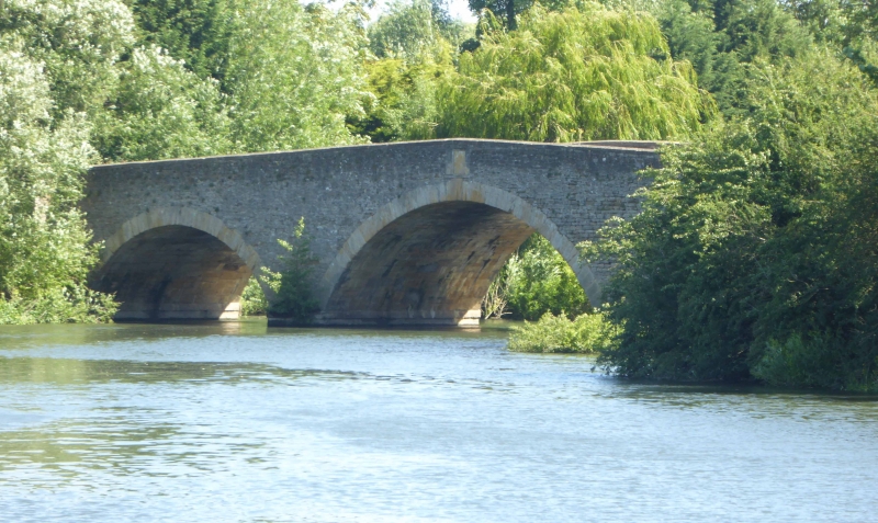
Bridge. c.1807. Coursed stone rubble with ashlar stone dressings. 3 round arches with keystones to centre. Single arches with keystones to wider ends of bridge. Causeways to north and south on 3 round arches. Plain parapet with some C20 alterations. (V.C.H.: Oxfordshire, Vol.7, p.28, 1962).
Listing NGR: SU5090194815


Other nearby listed buildings